Introduction
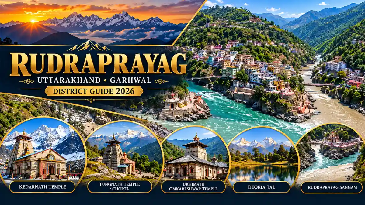
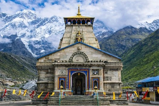
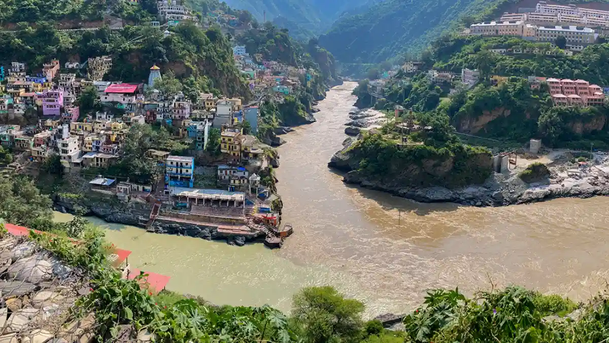
Rudraprayag district is a Himalayan district in Uttarakhand’s Garhwal division. It is best known as the home of Kedarnath, one of the twelve Jyotirlingas, and for the Rudraprayag Sangam, where the Alaknanda and Mandakini rivers meet. The district also includes Tungnath, Madmaheshwar, Chopta, Deoria Tal, Guptkashi, Ukhimath, and Triyuginarayan.
Rudraprayag is one of the 13 districts of Uttarakhand and the least populous of them. This guide covers its history, places to visit, the Kedarnath route, travel, weather, sports, culture, and public services.
Many travellers search for places they assume are in Rudraprayag. Kedarnath, Chopta, Tungnath, Triyuginarayan, Guptkashi, Ukhimath and Augustmuni are all in Rudraprayag district, while Rudranath and Kalpeshwar, the other two Panch Kedar shrines, are in Chamoli district.
District at a Glance
- State: Uttarakhand; division: Garhwal.
- Headquarters: Rudraprayag town, at the confluence of the Alaknanda and Mandakini.
- Established: 16 September 1997, carved out of Chamoli, Tehri Garhwal and Pauri Garhwal districts.
- Area: Approximately 1,984 square kilometres. Some older official documents give a larger figure of about 2,439 square kilometres.
- Population: 2,42,285, according to the 2011 census, the lowest of any district in Uttarakhand. This is a historical census figure, not a current estimate.
- Sex ratio (Census 2011): 1,120 females per 1,000 males; literacy: about 82 per cent.
- Language: Garhwali is the first language of about 94 per cent of the population.
- Three development blocks: Agastmuni (Agastmuni), Jakholi and Ukhimath.
- Tehsils include: Rudraprayag, Ukhimath, Jakholi and Basukedar. Check the district website for the current list.
- Rudraprayag PIN code: 246171; STD code: 01364.
- Main attractions: Kedarnath, Rudraprayag Sangam, Tungnath and Chandrashila, Chopta, Deoria Tal, Triyuginarayan, Guptkashi, Ukhimath and Madmaheshwar.
Location and Geography
Rudraprayag district lies in the Garhwal Himalaya of northern Uttarakhand. It is bounded by Uttarkashi district to the north, Chamoli to the east, Pauri Garhwal to the south, and Tehri Garhwal to the west. Rudraprayag town sits at an average elevation of about 895 metres, while the district rises from river valleys to glaciers and snow peaks in the north.
The Mandakini is the main river of the district. It begins near the Chorabari glacier close to Kedarnath and joins the Alaknanda at Rudraprayag. Sonprayag, on the Kedarnath route, is where the Basuki and Mandakini meet.
About 58 per cent of the district is forest, and the Kedarnath Wildlife Sanctuary covers about 966 square kilometres in the north. The terrain is steep, and places that look close on a map can take hours to reach by road, so plan journeys by valley and highway corridor.
History of Rudraprayag District
Rudraprayag district was established on 16 September 1997. It was created from the whole of the Augustmuni and Ukhimath blocks and parts of the Pokhri and Karnaprayag blocks of Chamoli district, parts of the Jakholi and Kirtinagar blocks of Tehri Garhwal, and part of the Khirsu block of Pauri Garhwal. It became part of the new state of Uttarakhand in 2000.
The town is named after Rudra, an aspect of Lord Shiva, and is one of the five sacred confluences known as the Panch Prayag. According to tradition, Shiva appeared here in his Rudra form to bless the sage Narad. The Kedarnath valley is central to the Panch Kedar legend, in which the Pandavas sought Shiva’s forgiveness after the Mahabharata war, and Shiva took refuge at Kedarnath in the form of a bull.
Rudraprayag is also known from the writings of Jim Corbett. A man-eating leopard terrorised the Rudraprayag area between 1918 and 1926 and is reputed to have killed over 125 people. Corbett shot it on 2 May 1926 after a ten-week hunt. The June 2013 floods caused severe damage in the Kedarnath valley and altered the layout of the Rudraprayag Sangam area.
Famous Places to Visit in Rudraprayag District
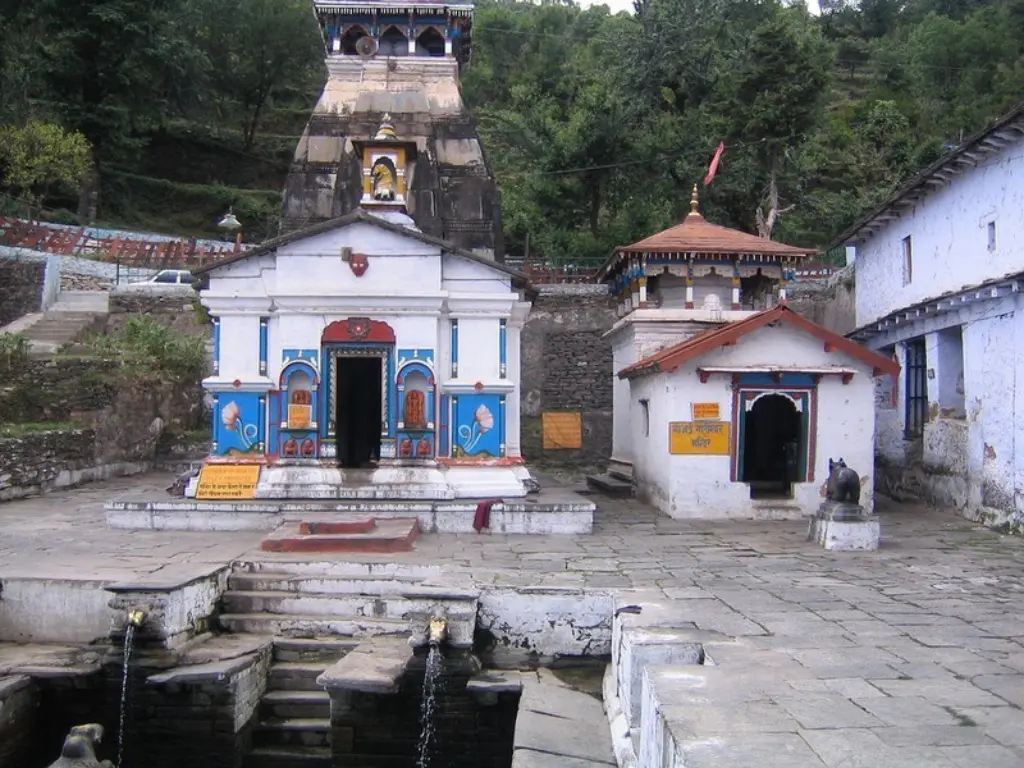
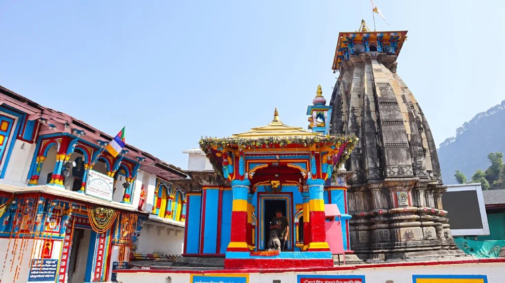
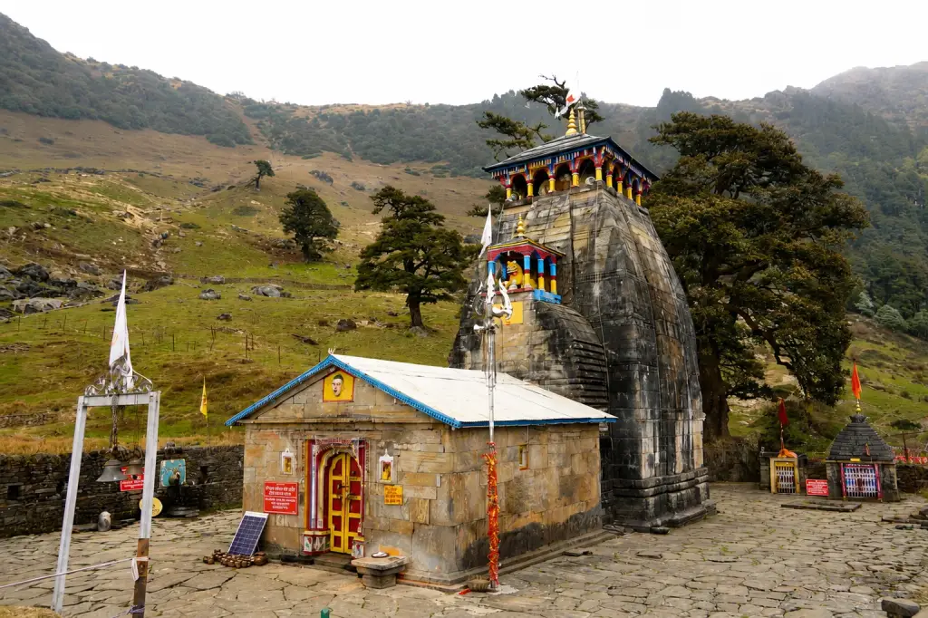
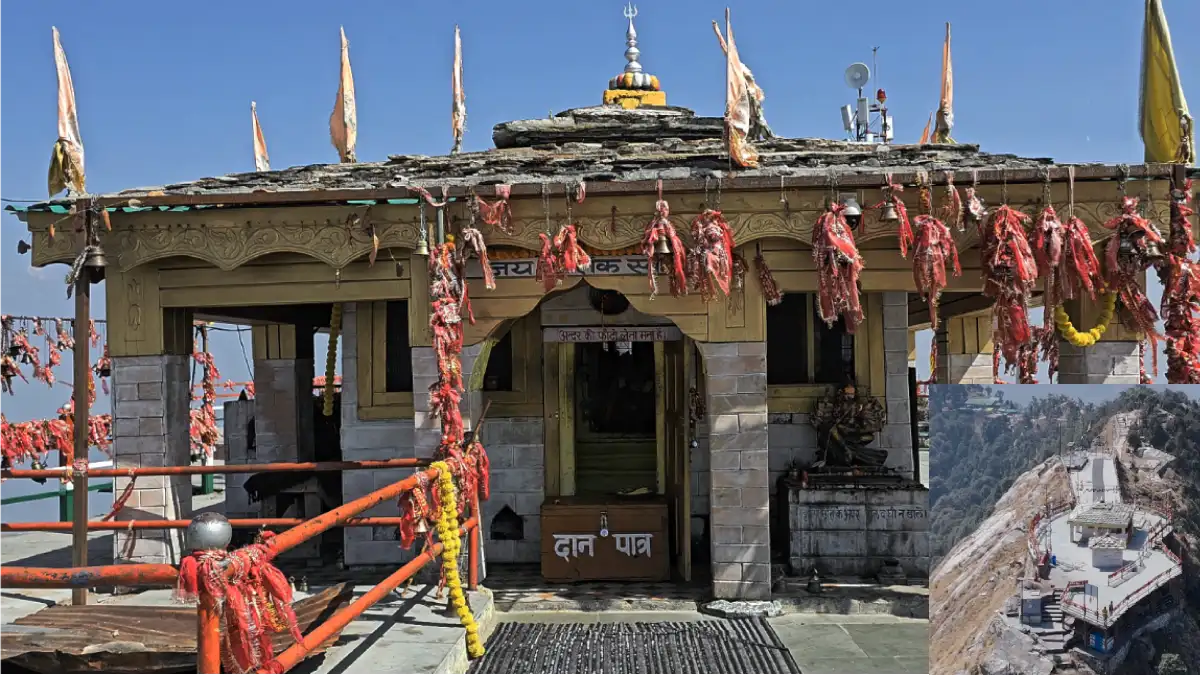
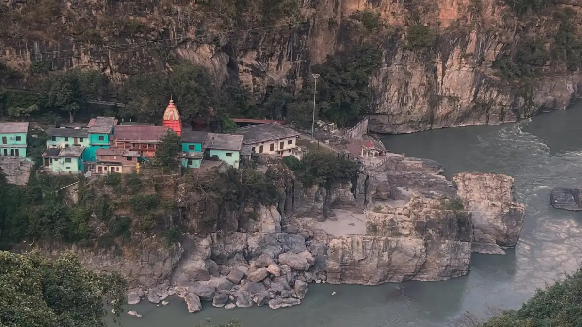
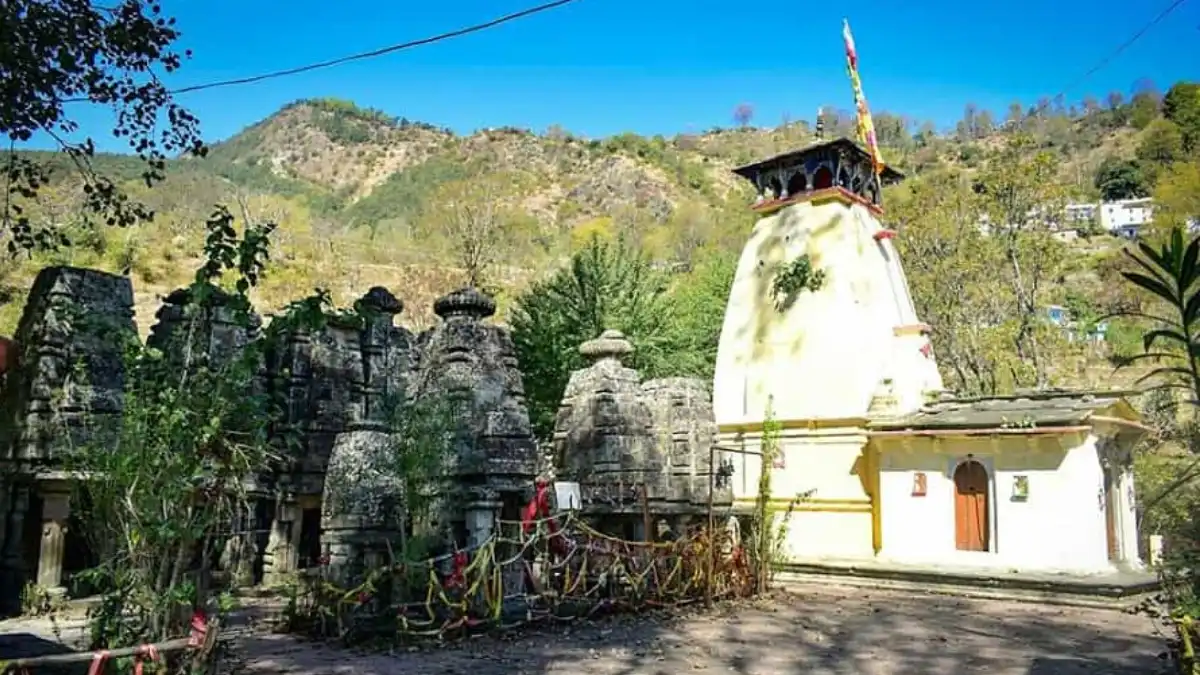
Distances in this guide are approximate. Opening dates, entry rules and seasonal access can change, so check the current arrangements for each place before you travel.
Religious and Heritage Sites
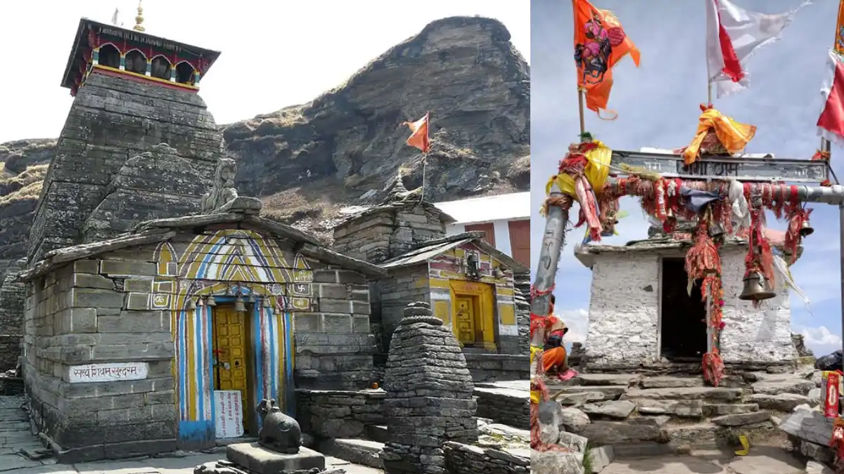
- Panch Kedar in the district: Kedarnath, Tungnath and Madmaheshwar lie in Rudraprayag district. The other two, Rudranath and Kalpeshwar, lie in Chamoli.
- Kalimath: A Siddha Peeth near Ukhimath and Guptkashi with a Kali temple, visited throughout the year and especially during Navratri.
- Haryali Devi: A Siddha Peeth at about 1,400 metres, reached by a road that branches off at Nagrasu on the Rudraprayag-Karnaprayag route.
- Indrasani Mansa Devi: A temple at Kandali Patti, about 14 km from Rudraprayag, associated in tradition with Adi Shankaracharya.
- Chamunda Devi Temple: A temple at the Alaknanda-Mandakini confluence.
- Omkareshwar Temple, Ukhimath: The winter home of the Kedarnath deity.
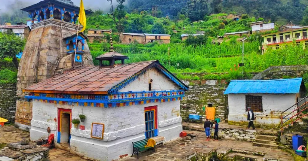
- Triyuginarayan: The temple where, according to tradition, Shiva and Parvati were married.
Many of these are active places of worship. Dress modestly, follow temple rules, and take extra care on steep paths and near fast-flowing rivers.
Kedarnath Yatra at a Glance
- Season: The Kedarnath temple is open for only part of the year. Opening and closing dates are announced each year and change with the Hindu calendar, so confirm them before you plan.
- Winter: When the temple is closed, the deity is worshipped at the Omkareshwar temple in Ukhimath.
- Route: The usual road route is Rudraprayag, Guptkashi, Sonprayag, and Gaurikund, which is the last road point. Sonprayag is about 5 km before Gaurikund.
- Trek: The trek from Gaurikund to Kedarnath is about 16 km one way.
- Helicopter services: Services operate from helipads such as Phata, Guptkashi, and Sersi during the season; confirm current operators and rules.
- Registration: Registration is required for the Char Dham yatra; use the official registration portal.
Kedarnath lies at about 3,584 metres, so weather can change quickly, and altitude can affect some visitors. Check the route and weather forecast before you set out, and follow official advisories.
How to Reach Rudraprayag
By air: The nearest airport is Jolly Grant Airport near Dehradun, roughly 160-180 km from Rudraprayag depending on the route. Taxis and buses are available for the onward journey.
By rail: The nearest railhead is Rishikesh, about 140 km from Rudraprayag. Haridwar and Dehradun are the other major stations with long-distance trains.
By road: Rudraprayag lies on the Rishikesh-Badrinath highway. Rishikesh is about 140 km away, a drive of roughly four to six hours depending on traffic and road conditions, and Srinagar (Garhwal) is about 33 km away. Regular buses run from Rishikesh, and shared taxis serve the Kedarnath and Chopta routes.
Approximate road distances from Rudraprayag: Koteshwar 3 km, Augustmuni about 18 km, Guptkashi about 39 km, Ukhimath about 40 km, and Gaurikund about 72 km. Kedarnath is about 72 km by road to Gaurikund plus a 16 km trek. Badrinath is roughly 160-165 km away. These are approximate route distances, not guaranteed travel times, and landslides can cause delays. Confirm current bus or shared-taxi services before departure.
Weather and Best Time to Visit
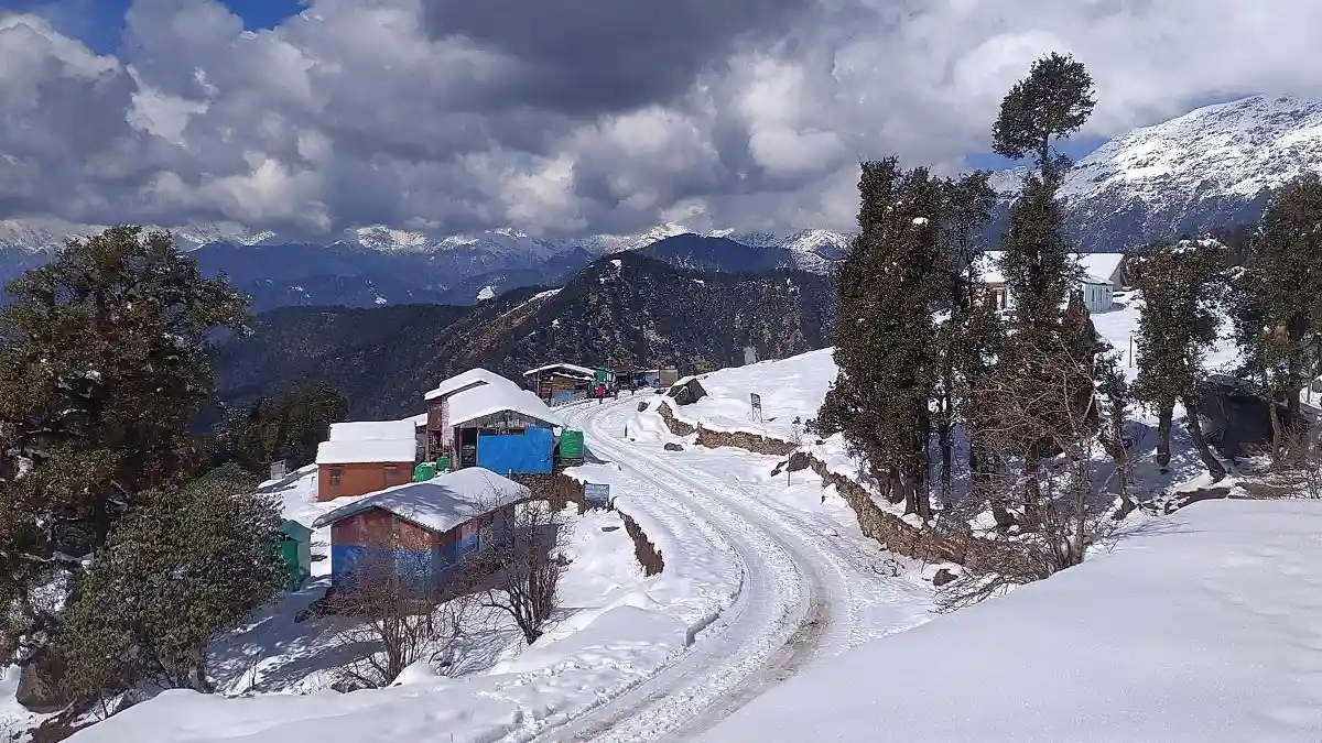
Rudraprayag’s weather depends largely on altitude. The river valleys are warm in summer, while Chopta, Tungnath, Deoria Tal and the Kedarnath area are much colder and see heavy snow in winter.
Live weather for Rudraprayag. Higher areas such as Chopta and Kedarnath are much colder.
The best season depends on the destination and activity.
- Winter (mid-November to March): Cold, with snow in the higher areas and considerable snow accumulation in valleys. The Kedarnath temple is closed, and high-altitude treks need suitable equipment and experienced arrangements.
- Spring and early summer (April to June): The main pilgrimage and trekking season, with pleasant hill weather. Expect heavy crowds on the Kedarnath route.
- Monsoon (July to September): Most of the year’s rain falls in these months, and landslides can block roads and trails. Check current conditions before travelling.
- Autumn (October to early November): Often considered good for clear mountain views, with colder nights at higher elevations. Check the temple closing date.
Check the forecast for your actual destination and dates rather than relying on a district-wide temperature estimate.
Rudraprayag Map and Location
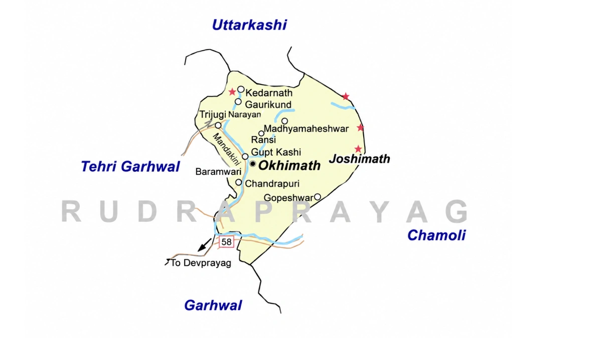
On the Rudraprayag map, the district sits in the heart of the Garhwal Himalaya, with Rudraprayag town at the meeting point of the Alaknanda and Mandakini. The district is bordered by:
- North: Uttarkashi district.
- East: Chamoli district.
- South: Pauri Garhwal district.
- West: Tehri Garhwal district.
Kedarnath lies in the north of the district, Madmaheshwar in the east, and Srinagar (Garhwal) just beyond the southern edge. Use an official map or navigation app for road distances and current route conditions.
Accommodation and Where to Stay
Choose your overnight base around the main purpose of the trip:
- Rudraprayag town: A convenient junction for the Kedarnath and Badrinath routes.
- Augustmuni: A market town on the Mandakini, with a Forest Rest House and private hotels.
- Guptkashi and Ukhimath: Common bases for the Kedarnath route and Chopta.
- Chopta and Sari: Simple stays and camps for the Tungnath and Deoria Tal treks.
- Sonprayag, Gaurikund and Kedarnath: Basic lodges close to the trek, which fill up early in the yatra season.
Options include hotels, guesthouses, homestays, camps and government rest houses. Confirm heating, meals, hot water, road access, and cancellation terms directly, and book early for May and June. Remote stays may offer fewer services than town hotels.
Suggested Itineraries
These are planning examples, not fixed packages or confirmed operating routes.
- One to two days around Rudraprayag: Visit the Sangam and Koteshwar, then continue to Augustmuni.
- Kedarnath yatra: Allow at least three days from Rudraprayag or Guptkashi, covering the road to Gaurikund, the trek, rest at Kedarnath, and the return, with extra time in case of weather delays.
- Chopta, Tungnath and Chandrashila: Plan two to three days, with a night at Chopta so that you can trek in the morning.
- Deoria Tal and Chopta: Combine the short Sari-Deoria Tal trek with Chopta and Tungnath over three to four days.
- Panch Kedar in the district: Kedarnath, Tungnath, and Madmaheshwar are separate journeys, so plan them across several days.
Adjust the plan to your starting city, fitness, transport, and season. Covering the entire district in a weekend is unrealistic.
Sports and Adventure in Rudraprayag
Rudraprayag’s sporting life is shaped by its mountains. The Chopta-Tungnath-Chandrashila trail, the short Deoria Tal trek, and the long Panch Kedar routes make trekking the district’s best-known outdoor activity. Official tourism information describes Chandrashila climbs arranged by Garhwal Mandal Vikas Nigam (GMVN), combining trekking with snow activities in winter.
Trekking and high-altitude walking are very different from a casual walk. Choose a route that suits your fitness, ask the organiser for a day-by-day itinerary and elevation profile, and check permit and weather conditions before you go. Some trails pass through the Kedarnath Wildlife Sanctuary, where forest rules apply.
For competitive sport, students and parents should enquire through their school, college or the District Sports Office about coaching and the pathway to recognised competitions. A disciplined routine, qualified guidance and a record of performances help athletes prepare for trials.
Sports Facilities, Training and Athlete Opportunities
The Sports Department of the Government of Uttarakhand runs district-level programmes through the District Sports Office, Rudraprayag. Use the district website to find the current contact details, and ask about coaching, trials, age groups, and documents required.
Local news reports in 2026 mention a mini stadium in the district where a spectator gallery and toilets were planned, and a separate proposed stadium near Augustmuni on which the administration invited public objections about the land. Facilities and plans change, so confirm the current status with the District Sports Office before travelling to a venue.
Note that Rudrapur, which has a sports stadium, is a different place in Udham Singh Nagar district. Larger state-level training facilities are concentrated in other districts, and young athletes from Rudraprayag often move to them as they progress.
For scholarships, hostel admissions or equipment assistance, refer to a current official notice from the Department of Sports. Keep age, residence and achievement records ready; availability and eligibility differ between programmes.
Sportspersons from Rudraprayag
Rudraprayag is better known for pilgrimage, trekking and mountain culture than for any single competitive sport. Young players from the district, like those from other hill districts, usually progress through school teams, district competitions and then state-level programmes run by the Sports Department.
This guide lists only sportspersons whose connection to the district is clearly documented, and the section will be updated as verified profiles are added. Young players can start with school and club programmes and learn about the state’s selection pathways.
Education, Training and Research Institutions
The district website lists the following institutions in Rudraprayag district:
- Government Degree College, Rudraprayag and Government Degree College, Guptkashi: Degree colleges in the district.
- District Institute of Education and Training (DIET), Ratura: A teacher-training institution.
- Jawahar Navodaya Vidyalaya, Jakhdhar (Guptkashi): A residential school for talented rural students.
- Kendriya Vidyalaya, Augustmuni: A central government school.
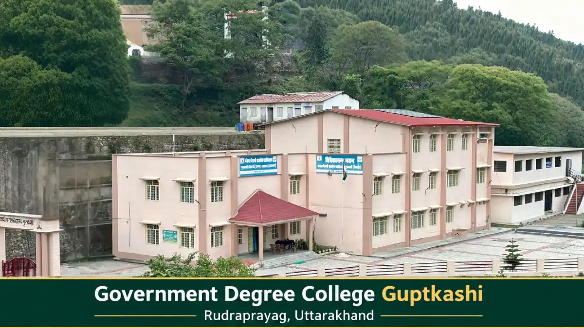
Students should check current courses, admissions, fees, and eligibility directly with each institution. Many students from the district also study in Srinagar (Garhwal), Dehradun and other cities.
Administrative Structure
The District Magistrate heads the district administration; for the current officer and contact details, use the district website. Revenue administration operates through tehsils, while development blocks support local planning and programme implementation.
The district has three development blocks: Augustmuni, Jakholi and Ukhimath. Tehsils include Rudraprayag, Ukhimath, Jakholi and Basukedar; check current district notices, as administrative units can change.
Rudraprayag town is governed by the Nagar Palika Parishad. Nagar Panchayats include Augustmuni, Ukhimath, Tilwara, and Kedarpuri (the Kedarnath area). For a certificate or local service, first identify the relevant village, block, tehsil, or municipal office.
Important Towns and Settlements
- Rudraprayag: District headquarters and the junction for Kedarnath and Badrinath.
- Augustmuni: A block headquarters and market town on the Mandakini.
- Guptkashi: A pilgrim town and a main base for the Kedarnath route.
- Ukhimath: A tehsil headquarters and the winter seat of Kedarnath.
- Sonprayag, Gaurikund and Phata: Settlements on the Kedarnath route.
- Chopta and Sari: High-altitude villages and trek bases.
- Jakholi and Tilwara: Settlements in the southern part of the district.
- Kalimath: A religious village near Ukhimath and Guptkashi.
These places lie along different travel corridors. Select accommodation and transport according to the destination you intend to explore.
Nature and Biodiversity
More than half of the district is forest. The landscape ranges from valley slopes to alpine meadows, glaciers and snow peaks, and the northern part forms the Kedarnath Wildlife Sanctuary, which was established in 1972 and covers about 966 square kilometres.
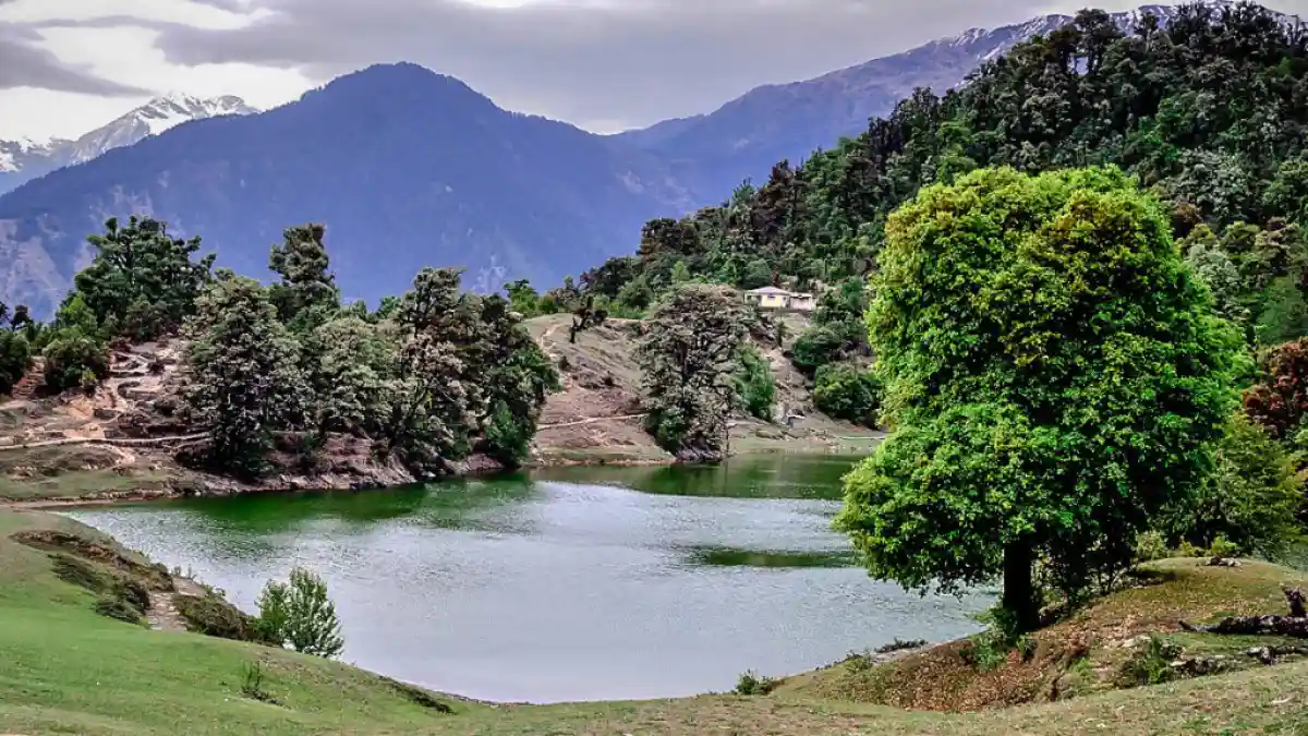
The Chorabari glacier near Kedarnath is the source of the Mandakini, and high-altitude lakes such as Vasuki Tal, at about 4,135 metres, and Gandhi Sarovar lie near the Kedarnath area. Deoria Tal sits in the buffer zone of the sanctuary, and the trails around Chopta pass through rhododendron and forest areas.
Wildlife sightings are never guaranteed. Protected-area visits may require permits and designated routes, so check the relevant forest authority’s arrangements before you plan an excursion, and avoid littering at high-altitude lakes and meadows.
Culture, Traditions, Festivals and Fairs
Rudraprayag’s culture is rooted in Garhwali traditions and the pilgrimage economy of the Kedarnath valley. Garhwali is the first language of most residents, and village shrines and local deity traditions remain part of community life.
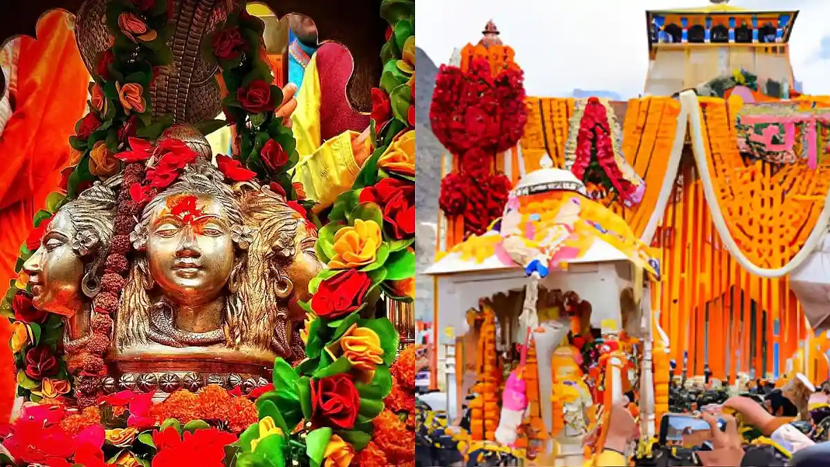
Each year, the Kedarnath Panchmukhi Doli leaves the Omkareshwar temple at Ukhimath in a ceremonial procession to the Kedarnath shrine when the temple opens, and returns when it closes for winter. A large fair is held at Augustmuni on Baisakhi, and devotees visit the Haryali Devi temple in large numbers on Janmashtami and Diwali.
Dates and programmes differ from year to year. Village celebrations also vary across the district, so ask local hosts about the customs of the place you are visiting rather than assuming every community follows the same practice.
Local Food
Food in Rudraprayag reflects the mountain cuisine of Garhwal and locally available crops. Depending on the household and season, meals may feature mandua, jhangora, pulses, leafy vegetables, and simple home-style preparations.
Regional dishes to ask about include kafuli, phaanu and chainsoo. These belong to Uttarakhand’s broader culinary tradition and may not appear on every restaurant menu. On the pilgrimage route, small eateries serve simple vegetarian meals.
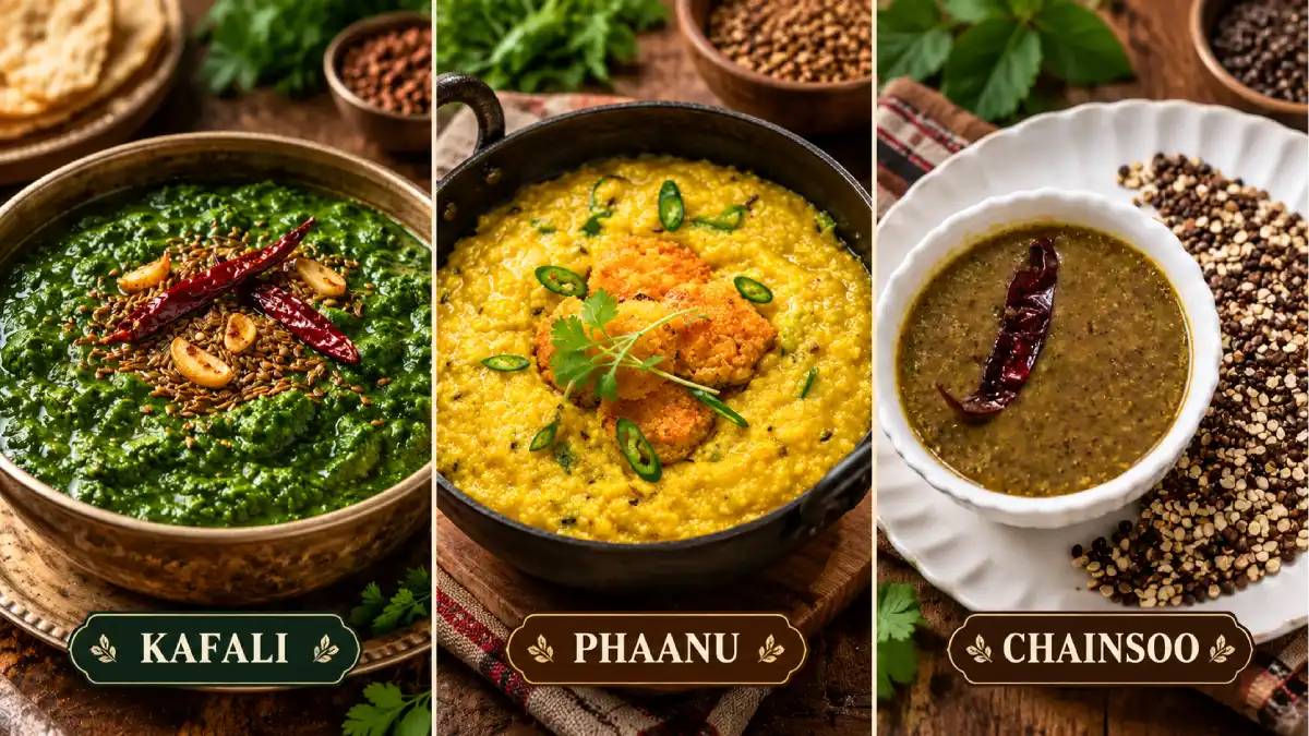
Homestays can be a good place to learn about household food traditions. Confirm meals in advance, especially if you have dietary requirements or will arrive late, and expect limited choices at high-altitude stops.
Livelihoods and the Local Economy
Pilgrimage and trekking are the district’s largest visible source of work, supporting hotels, shops, transport, ponies and palanquins, guides and helicopter services during the Kedarnath season. These opportunities are seasonal and depend on road access, weather and visitor numbers.
Agriculture on terraced fields, livestock and small trade support many rural households. Government services and education also employ people in the main towns.
Visitors can support the local economy through locally operated stays, produce and skilled services. Young people considering work in tourism, trekking or adventure should enquire about training, qualifications and the operating requirements for the activity they want to pursue.
Healthcare, District Administration and Emergency Contacts
Emergency assistance: 112 | Ambulance: 108 | Disaster helpline: 1077.
The District Hospital is in Rudraprayag, and the Chief Medical Officer’s office oversees health services in the district. Primary health centres serve Ukhimath and other areas, but facilities in remote and high-altitude places are limited and farther apart. Plan travel and medical needs, especially for the Kedarnath trek, where altitude and weather can affect health.
For district office and department numbers, use the directory on the District Administration website. Contacts and facilities were reviewed on 8 October 2026; telephone availability has not been tested. Use 112 for immediate emergencies.
Frequently Asked Questions
Which state is Rudraprayag in?
Rudraprayag is in Uttarakhand, in the Garhwal division.
Where is Rudraprayag district located?
It lies in the Garhwal Himalaya of northern Uttarakhand. It is bounded by Uttarkashi to the north, Chamoli to the east, Pauri Garhwal to the south and Tehri Garhwal to the west.
What is the Rudraprayag district headquarters?
The district headquarters is Rudraprayag town.
What is the area of Rudraprayag district?
The area is commonly given as about 1,984 square kilometres. Some older official documents give a larger figure of about 2,439 square kilometres.
What is the population of Rudraprayag district?
The Census 2011 district total is 2,42,285, the lowest in Uttarakhand. It should not be presented as a current estimate.
What is the tehsil list of Rudraprayag district?
Tehsils include Rudraprayag, Ukhimath, Jakholi, and Basukedar. Check the district website for the current list.
What is the list of blocks in Rudraprayag district?
There are three blocks: Augustmuni, Jakholi, and Ukhimath.
When was Rudraprayag district formed?
Rudraprayag district was established on 16 September 1997, from parts of Chamoli, Tehri Garhwal, and Pauri Garhwal districts.
What is Rudraprayag district famous for?
It is known for Kedarnath, the Rudraprayag Sangam, Tungnath and Chandrashila, Chopta, Deoria Tal, Triyuginarayan, and Jim Corbett’s man-eating leopard story.
Where can I find the Rudraprayag district villages list?
Village lists are available in the Census of India village directory and on the district administration website. Use those sources for the current list rather than relying on a summary.
What is the Rudraprayag PIN code?
The PIN code of Rudraprayag town is 246171. Other places have their own codes; for example, Augustmuni 246421, Guptkashi 246439, and Ukhimath 246469.
Who is the DM of Rudraprayag?
The District Magistrate heads the district administration. Officers change with postings, so check the district website for the current DM and contact details.
Is Kedarnath in Rudraprayag district?
Yes. Kedarnath is in Rudraprayag district, so Rudraprayag is the answer to “Kedarnath district”.
Is Chopta in Rudraprayag district?
Yes. Chopta lies in Rudraprayag district, near the Ukhimath side, and is the base for the Tungnath trek.
Is Tungnath in Rudraprayag district?
Yes. Tungnath is in Rudraprayag district, about 3.5-4 km on foot from Chopta.
Which district is Triyuginarayan in?
Triyuginarayan is in Rudraprayag district.
Which district is Guptkashi in?
Guptkashi is in Rudraprayag district.
Which district is Ukhimath in?
Ukhimath is in Rudraprayag district. It is the winter seat of the Kedarnath deity.
Which district is Augustmuni in?
Augustmuni (Agastmuni) is in Rudraprayag district, about 18 km from Rudraprayag town.
Where is Rudraprayag Sangam?
Rudraprayag Sangam is in Rudraprayag town, where the Alaknanda and Mandakini rivers meet. It is one of the five Prayags.
Is Rudranath in Rudraprayag district?
No. Rudranath is in Chamoli district. Kedarnath, Tungnath and Madmaheshwar are the Panch Kedar shrines in Rudraprayag district.
Is Rudrapur in Rudraprayag district?
No. Rudrapur is a city in Udham Singh Nagar district, and Rudraprayag is a separate town and district in Garhwal.
What is the weather and temperature in Rudraprayag?
It depends on altitude. The valleys are warm in summer and cool in winter, while higher areas such as Chopta and Kedarnath are much colder and snowy in winter. Check the live forecast for your dates.
What is the best time to visit Rudraprayag?
April to June and September to November are generally the most comfortable, but the Kedarnath temple is open only part of the year. The monsoon can disrupt roads, and winter brings snow to the high areas.
Is there a stadium in Rudraprayag?
Local news reports mention a mini stadium in the district and a proposed new stadium near Augustmuni. Confirm the current status with the District Sports Office before you plan a visit.
Which sportspersons are from Rudraprayag?
Rudraprayag is better known for pilgrimage and trekking than for any single sport. This guide lists only sportspersons whose connection to the district is documented and will add verified profiles as they become available.
How to reach Rudraprayag?
The nearest railhead is Rishikesh, about 140 km away, and the nearest airport is Jolly Grant near Dehradun. The rest of the journey is by road along the Rishikesh-Badrinath highway.
What is the Rishikesh to Rudraprayag distance?
About 140 km by road, usually four to six hours depending on traffic and road conditions.
What is the Rudraprayag to Kedarnath distance?
About 72 km by road to Gaurikund, followed by a trek of about 16 km to the temple.
How long is the Deoria Tal trek?
The trek from Sari village to Deoria Tal is short, about 3 km one way, and is often combined with Chopta and Tungnath.
Where should I check current openings and permissions?
Use district administration notices, official tourism information, the Char Dham registration portal, and the relevant forest authority.
Useful Official Links
District Administration | Temples and Places of Interest | Uttarakhand Tourism | Char Dham Registration | Department of Sports | Disaster Management
Population and literacy: Census 2011. Area, blocks and forest cover: district statistical publications. History, places and distances: Rudraprayag district administration and district court website. Leopard history: published accounts of Jim Corbett’s hunt. Information reviewed: 8 October 2026.