Introduction
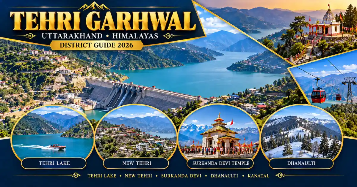
Tehri Garhwal district is a large Himalayan district in Uttarakhand’s Garhwal division. It is best known for the Tehri Dam (Tehri Bandh), the Tehri Lake behind it, and hill stations such as Dhanaulti and Kanatal. The district headquarters is New Tehri, a planned town built after the dam’s reservoir submerged the old Tehri town.
The district also includes Devprayag, where the Alaknanda and Bhagirathi meet to form the Ganga, along with Chamba, Narendranagar, Ghansali and the trekking valleys around Ghuttu. Tehri Garhwal is one of the 13 districts of Uttarakhand.
This guide covers its history, places to visit, the dam and lake, travel, weather, sports and water sports, education, culture and public services. Chamba, Ghansali, Dhanaulti and Devprayag are all in Tehri Garhwal district.
District at a Glance
- State: Uttarakhand; division: Garhwal.
- Headquarters: New Tehri.
- District since: August 1949, when the princely state of Tehri (Tehri Riyasat) merged into Uttar Pradesh and became a district.
- Area: About 4,080 square kilometres. Older district documents give slightly different figures.
- Population: 6,18,931, according to the 2011 Census. This is a historical census figure, not a current estimate.
- Sex ratio (Census 2011): 1,078 females per 1,000 males; Garhwali is the first language of about 90 per cent of the population.
- Nine development blocks: Bhilangana, Chamba, Devprayag, Jakhnidhar, Jaunpur, Kirtinagar, Narendranagar, Pratapnagar and Thauldhar.
- Tehsils include: Tehri, Ghansali, Devprayag, Narendranagar, Pratapnagar, Jakhnidhar and Dhanaulti. More tehsils have been added in recent years, so check the district website for the current list.
- PIN codes: New Tehri 249001, Narendranagar 249175, Ghansali 249155 and Chamba 249145; STD code (New Tehri): 01376.
- Main attractions: Tehri Dam and Lake, Dhanaulti, Surkanda Devi, Kanatal, Devprayag, Kunjapuri, Chandrabadni, Nag Tibba and the Ghuttu-Khatling treks.
Location and Geography
Tehri Garhwal lies on the southern slopes of the outer Himalaya in western Garhwal. It is bordered by Uttarkashi district on the north, Rudraprayag on the east, Pauri Garhwal on the south, and Dehradun on the west. Until 1997, the district extended much farther east, before part of its eastern area was used to form Rudraprayag district.
The Bhagirathi and Bhilangana rivers meet in the heart of the district, and the Tehri Dam stands on the Bhagirathi about 1.5 km downstream of that confluence. At Devprayag, on the southern edge of the district, the Alaknanda joins the Bhagirathi to form the Ganga.
Altitudes vary widely: Devprayag is at about 830 metres, New Tehri at roughly 1,900 metres, Dhanaulti at about 2,286 metres and Kanatal at roughly 2,400-2,600 metres. High-altitude trek destinations such as Khatling Glacier (about 3,700 metres) and Sahastra Tal lie farther north. Plan journeys by road corridor rather than by distance on a map, since hill roads can be slow.
History of Tehri Garhwal District
According to the district administration, the Gorkhas invaded Garhwal in 1803, and King Pradyumna Shah was killed in battle near Dehradun. His young son Sudarshan Shah was saved and later regained part of his kingdom with the help of the East India Company. The Company kept Kumaon, Dehradun and eastern Garhwal, and western Garhwal was given to Sudarshan Shah as the princely state of Tehri (Tehri Riyasat).
Sudarshan Shah made Tehri town his capital, and his successors later set up capitals at Pratapnagar, Kirtinagar and Narendranagar. The dynasty ruled from 1815 to 1949. After independence, the people of the state campaigned for freedom from the Maharaja’s rule, and in 1949 Tehri Riyasat merged into Uttar Pradesh and became a district. Uttarkashi was separated from it in 1960, and its eastern part was used to form Rudraprayag in 1997. The district became part of the new state of Uttarakhand in 2000.
The Tehri Dam project was conceived in 1949, construction began in 1978, and the dam was completed in 2006. The reservoir submerged the old Tehri town, and its residents were resettled at New Tehri.
Famous Places to Visit in Tehri Garhwal District
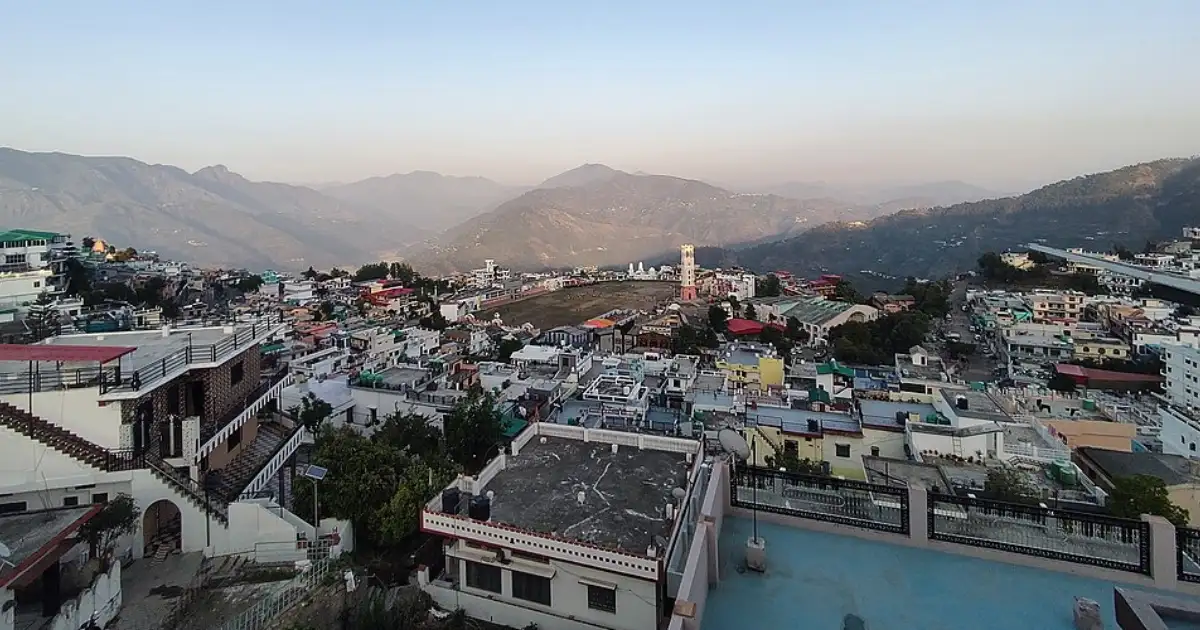
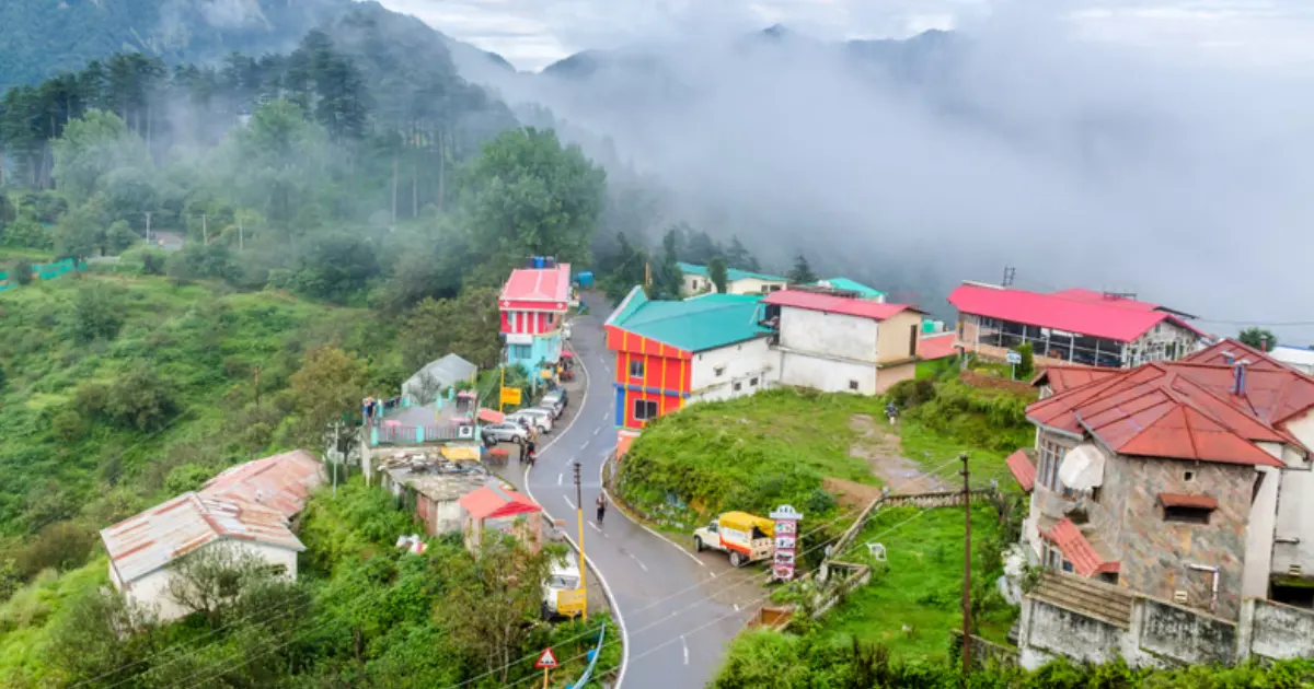
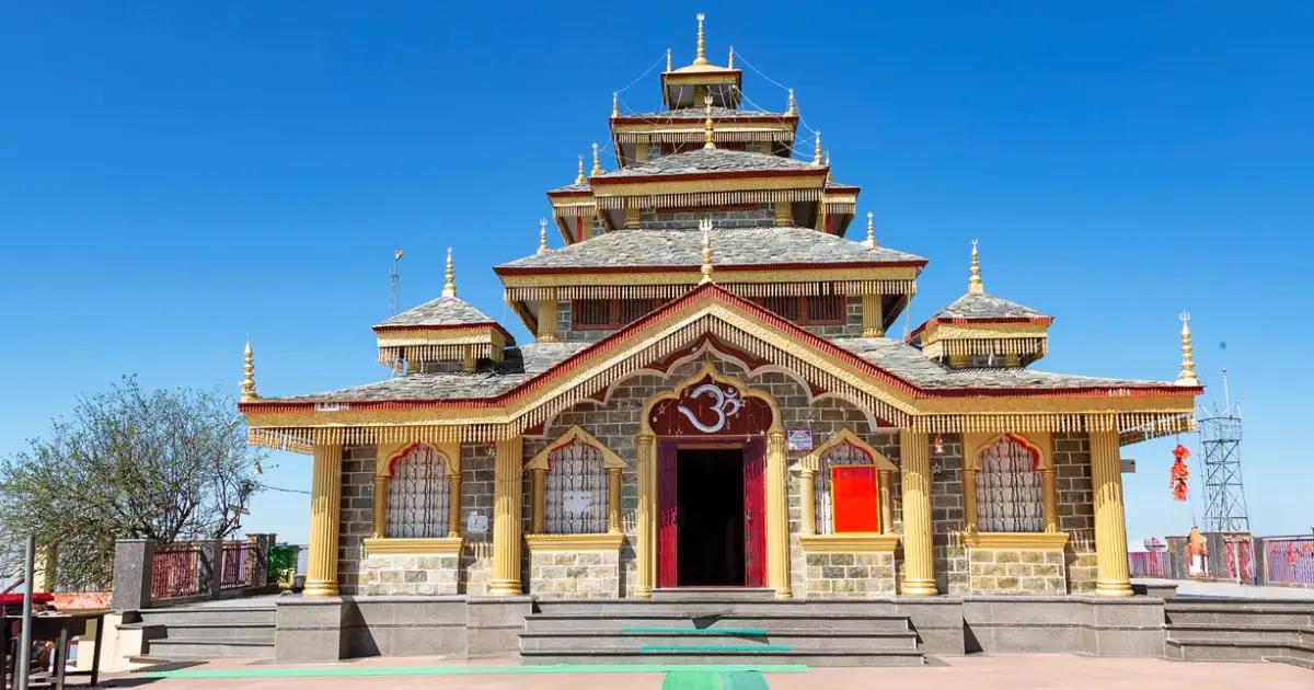
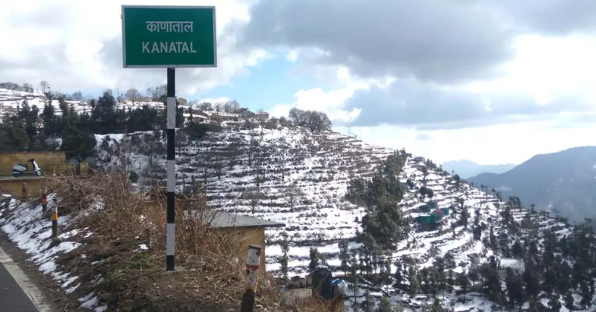
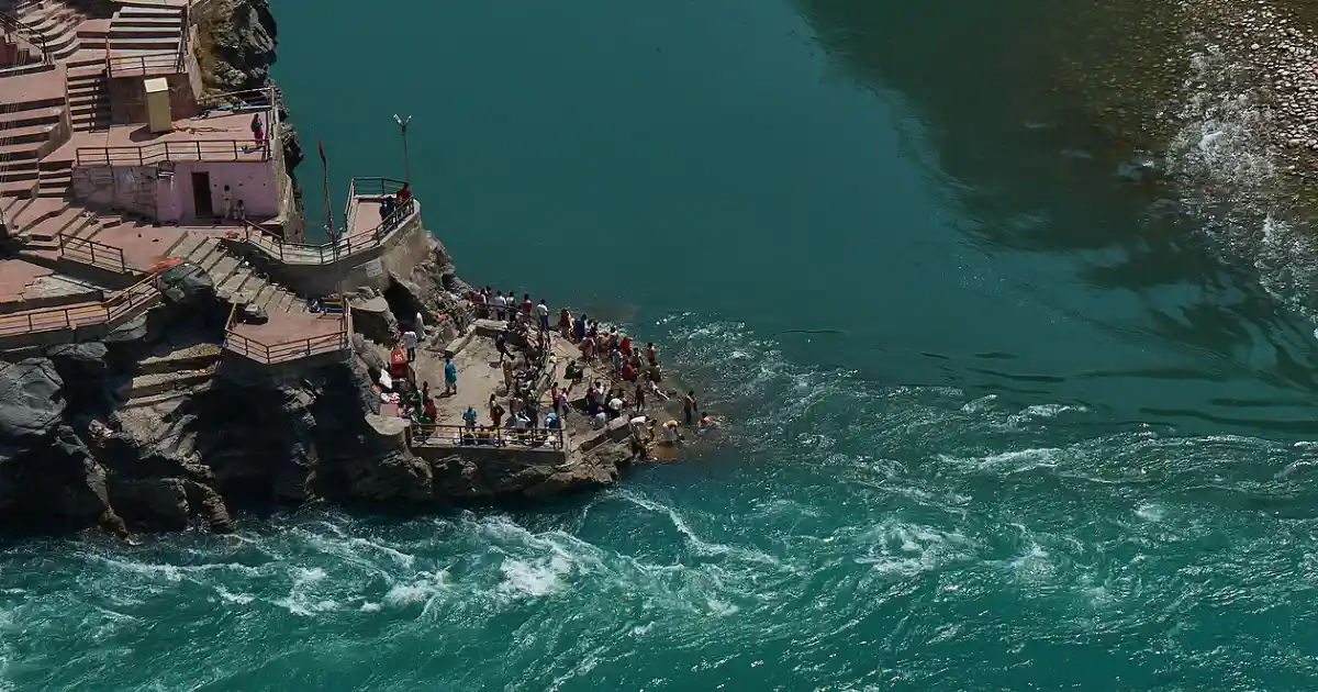
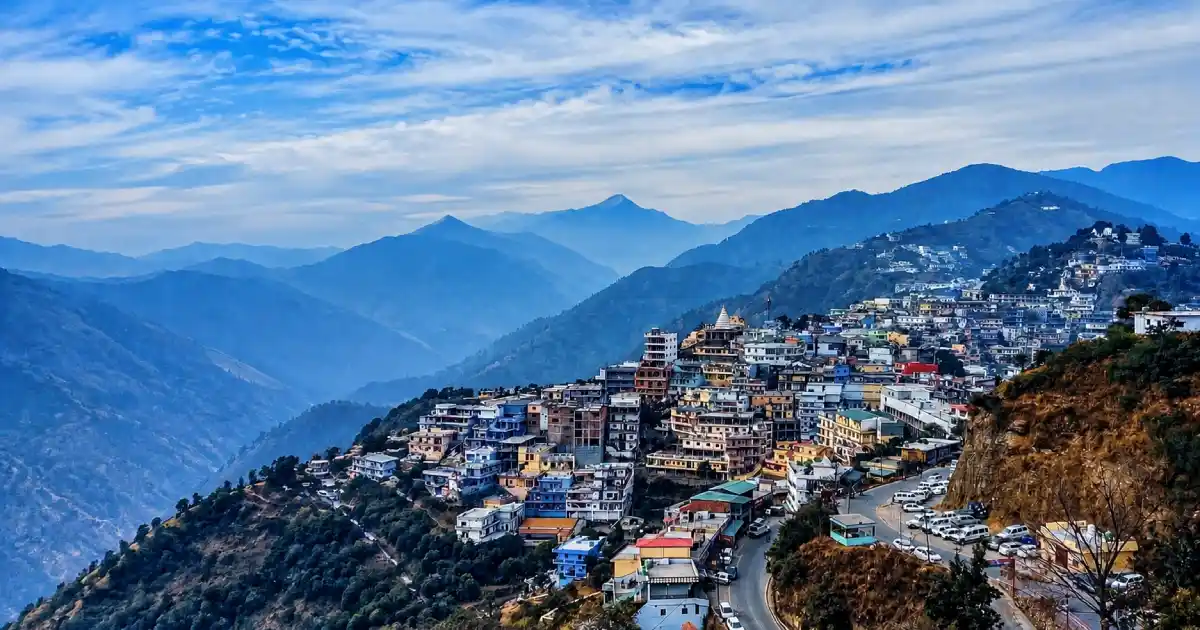
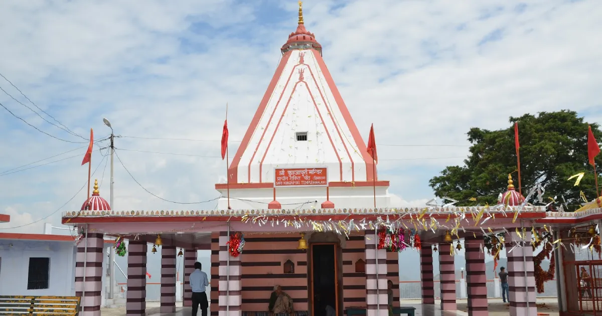
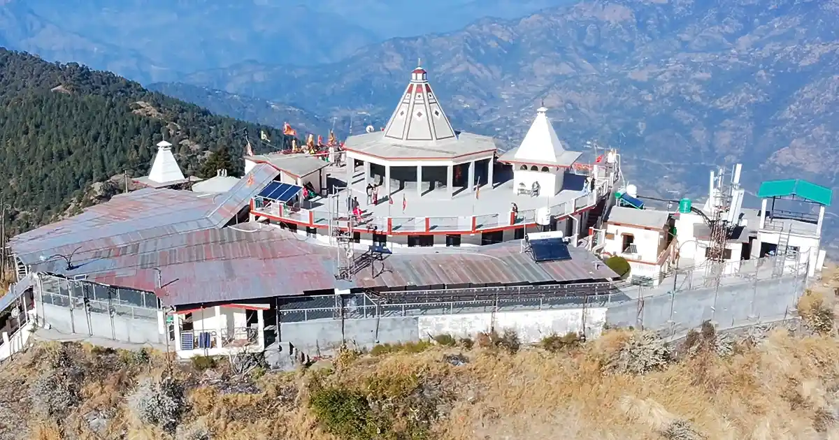
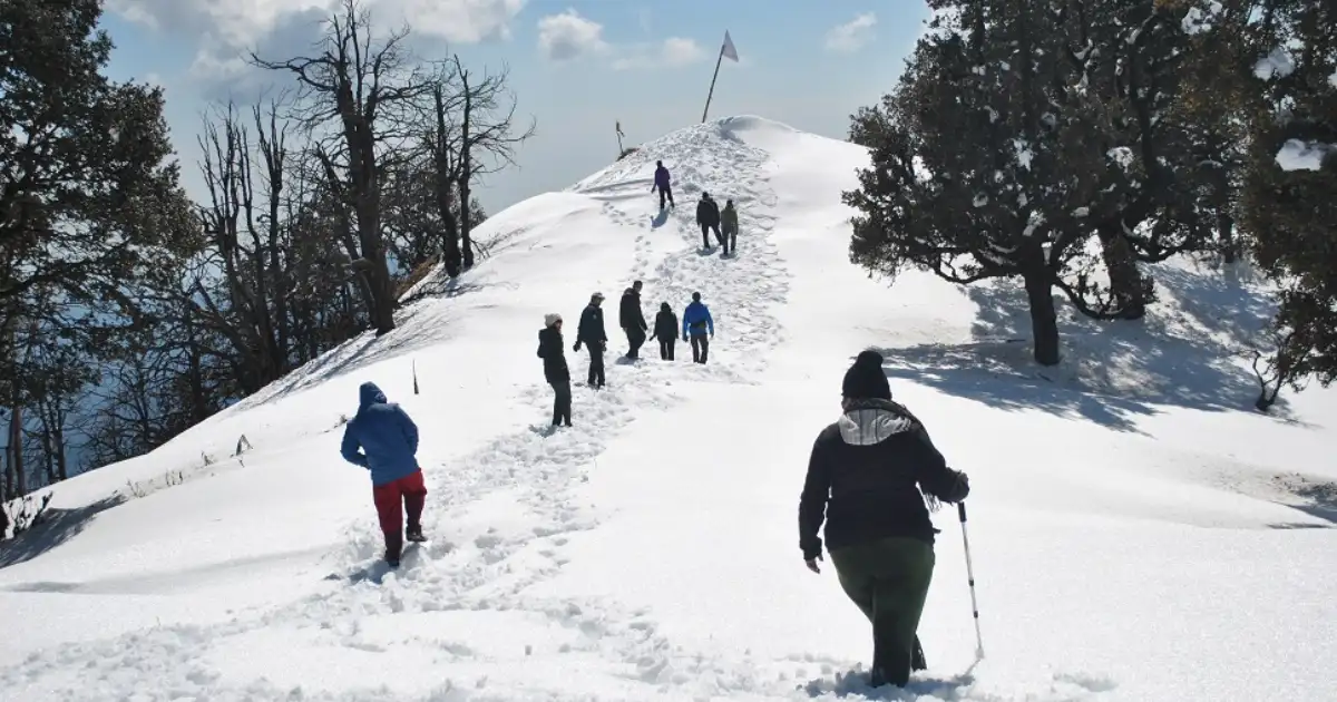
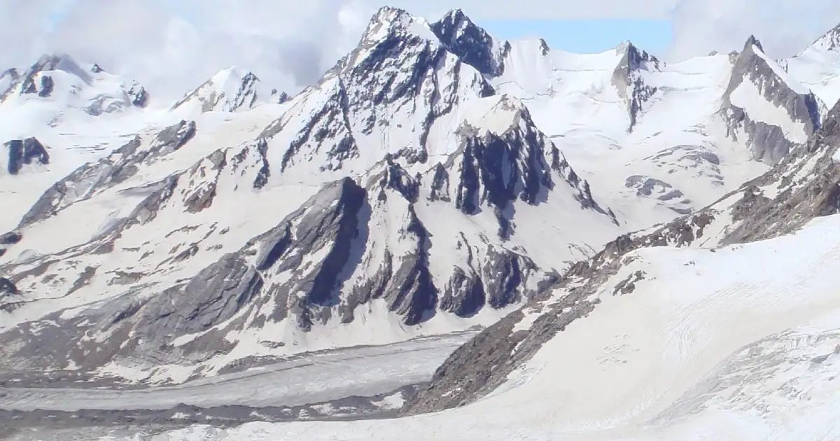
Distances in this guide are approximate. Opening days, entry rules and seasonal access can change, so check the current arrangements for each place before you travel.
Religious and Heritage Sites
- Devprayag Sangam: The confluence of the Alaknanda and Bhagirathi, where the Ganga takes its name, with the ancient Raghunath Temple dedicated to Lord Rama nearby.
- Surkanda Devi: A hilltop temple associated with the legend of Sati, known for its Ganga Dussehra fair.
- Chandrabadni and Kunjapuri: Hilltop shrines that, with Surkanda Devi, make up the Devi Darshan triangle.
- Sem Mukhem Nagraja Temple: A temple dedicated to Nag Raja.
- Buda Kedar Temple: A Shiva temple in the Balganga valley.
- Old royal capitals: Narendranagar, Kirtinagar and Pratapnagar recall the era of the Tehri kings.
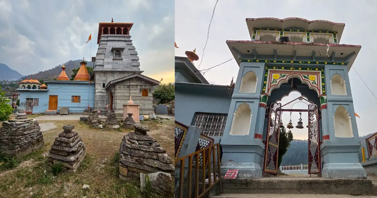
Many of these are active places of worship, and some are reached only on foot. Dress modestly, follow temple rules, and take care on steep hill paths.
Tehri Dam and Tehri Lake
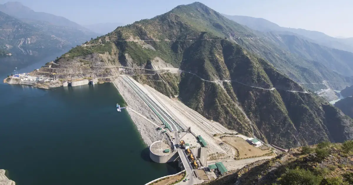
The Tehri Dam is a 260.5-metre earth and rockfill dam on the Bhagirathi, about 1.5 km downstream of its confluence with the Bhilangana. It is the tallest dam in India. Construction began in 1978, and the dam was completed in 2006.
The Tehri Hydro Power Complex has an installed capacity of 2,400 MW. It combines the 1,000 MW Tehri power plant, the 1,000 MW Tehri Pumped Storage Plant and the 400 MW Koteshwar project, which forms the lower reservoir. The dam is owned by THDC India Limited.
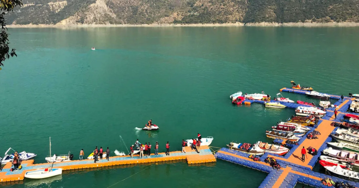
Tehri Lake is the reservoir created by the dam. It holds about 3.5 cubic kilometres of water, and published sources give its surface area as roughly 40-50 square kilometres. The reservoir submerged the old Tehri town. Koti Colony is the nearest access point for lake activities, and in March 2026 the Chief Minister announced a Koti Colony-New Tehri ropeway.
Access to dam and powerhouse areas is controlled for security reasons, so check current visitor arrangements with THDC and the district administration before you go.
How to Reach Tehri Garhwal
By air: The nearest airport is Jolly Grant Airport in Dehradun, about 76 km from New Tehri. Taxis and buses are available for the onward journey.
By rail: The nearest railway station is Rishikesh, about 71 km from New Tehri. Dehradun and Haridwar are the other major railheads.
By road: New Tehri is about 75 km from Rishikesh and about 99 km from Dehradun, and it is roughly 300-350 km from Delhi depending on the route. Chamba is the junction town where the roads to New Tehri and Mussoorie meet. Buses and shared taxis run from Rishikesh and Dehradun.
Other approximate distances: Dhanaulti is about 40 km from New Tehri and 24-30 km from Mussoorie, and Kanatal is about 38 km from Mussoorie. These are approximate route distances, not guaranteed travel times. Landslides can delay journeys during the monsoon, so confirm current bus or shared-taxi services before departure.
Weather and Best Time to Visit
Tehri Garhwal’s weather depends on altitude. Devprayag and the lower valleys are warmer, while New Tehri, Dhanaulti, Kanatal and the trek routes are much colder in winter.
Live weather for New Tehri. Higher areas such as Dhanaulti and Kanatal are colder.
The best season depends on the destination and activity.
- Winter (December to February): Cold, with winter temperatures at Dhanaulti typically between about -1°C and 7°C. Snowfall is possible in December and January at places such as Dhanaulti, Surkanda Devi and Kanatal, and heavy snow can block roads.
- Spring and early summer (March to June): Generally pleasant for sightseeing, treks and the lake, and one of the best times to visit.
- Monsoon (July to September): Heavy rain can cause landslides and delays on hill roads. Check current conditions before travelling.
- Autumn (October to November): Often clear and comfortable, with good mountain views.
March to June and September to November are generally the most comfortable months for New Tehri. Check the forecast for your actual destination and dates rather than relying on a district-wide temperature estimate.
Tehri Garhwal Map and Location
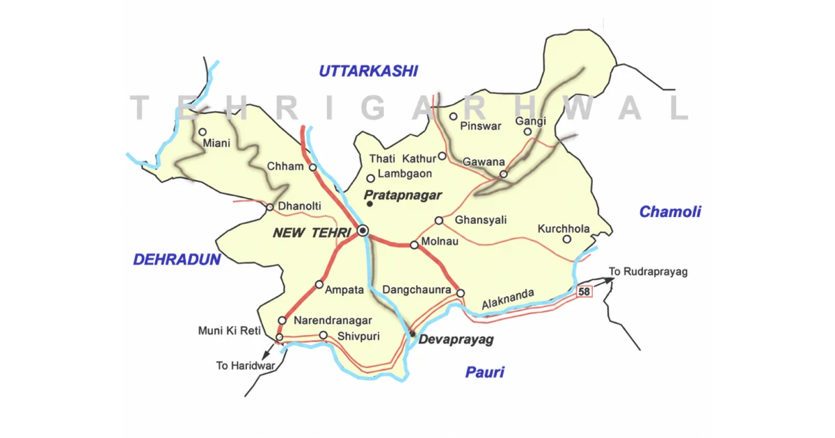
On the Tehri Garhwal district map, the district sits in western Garhwal in the northwestern part of Uttarakhand, with New Tehri near the centre. It is bordered by:
- North: Uttarkashi district.
- East: Rudraprayag district.
- South: Pauri Garhwal district.
- West: Dehradun district.
Muni Ki Reti, which adjoins Rishikesh, is in Tehri Garhwal district. Use an official map or navigation app for road distances and current route conditions.
Accommodation and Where to Stay
Choose your overnight base around the main purpose of the trip:
- New Tehri and Koti Colony: Convenient for the dam, the lake, and water sports.
- Chamba: A practical junction stop on the way to Kanatal, Dhanaulti and New Tehri.
- Dhanaulti and Kanatal: Hill-station stays, with cooler weather and snow in winter.
- Devprayag: Suited to a short pilgrimage stop at the confluence.
- Ghuttu and Pantwari: Basic village stays and camps for trek departures.
Options include hotels, guesthouses, homestays, resorts and camps. Confirm heating, meals, hot water, parking, road access, and cancellation terms directly. Remote stays may offer fewer services than town hotels, and winter snow can affect access.
Suggested Itineraries
These are planning examples, not fixed packages or confirmed operating routes.
- One to two days at New Tehri: See the dam viewpoints and spend time at Tehri Lake, adding water sports at Koti Colony when they are operating.
- Two to three days on the Chamba–Kanatal–Dhanaulti circuit: Combine the hill stations with Surkanda Devi, allowing for hill-road travel times.
- A Devprayag stop: Visit the confluence and temple, either as a short pilgrimage detour or alongside a trip to Rishikesh.
- Nag Tibba weekend: Start from Pantwari village and keep a buffer for weather.
- Ghuttu and Khatling: A multi-day high-altitude trek for experienced participants, with permissions and a prepared operator.
Adjust the plan to your starting city, fitness, transport, and season. Covering the entire district in a weekend is unrealistic.
Sports in Tehri Garhwal
Tehri Garhwal’s sporting identity is closely tied to the lake and the mountains. Tehri Lake has become a venue for kayaking, canoeing and rowing, and the district’s peaks and valleys have produced mountaineers. At the 38th National Games in 2025, the rowing competition was held at Tehri.
Students and parents should enquire through their school, college or the District Sports Office about coaching and the pathway to recognised competitions. A disciplined routine, qualified guidance and a record of performances help athletes prepare for trials.
Coaching availability differs by sport and location. Confirm the current programme before travelling to a facility or enrolling a child.
Water Sports in Tehri Lake
Tehri Lake is Uttarakhand’s best-known water sports destination. The Uttarakhand tourism board lists activities such as boating, jet skiing, banana boat rides, water skiing, canoeing and kayaking, and the Himalayan O₂ Tehri Lake Festival in March 2026 featured kayaking, canoeing, jet skiing, parasailing and scuba diving. Koti Colony is the nearest access point.
Competitions: THDC India Limited has hosted the Tehri Water Sports Cup at the lake, including an Open National Canoeing Sprint Championship and the 37th National Games qualifier in September 2023, with about 450 players from 22 states. An Indian Canoe League and the 4th Tehri Water Sports Cup were scheduled at Tehri Lake for 28–30 November 2025.
Which activities run on a given day depends on the season, water level, weather, and licensed operators. Use registered operators, wear a life jacket, and follow safety briefings. If you want river rafting instead, Shivpuri on the Ganga near Rishikesh is a popular base, generally best in September–October and March–May.
Sports Facilities, Training and Athlete Opportunities
The Sports Department of the Government of Uttarakhand runs district-level programmes through the District Sports Office, Tehri Garhwal. Use the district website to find the current contact details, and ask about coaching, trials, age groups, and documents required.
For water sports, Tehri Lake is the main venue, and THDC India Limited works with the Indian Kayaking and Canoeing Association and the Uttarakhand Olympic Association on national events. For mountaineering, the Nehru Institute of Mountaineering in Uttarkashi offers formal courses; check its official website for schedules, medical requirements, and eligibility.
For scholarships, hostel admissions or equipment assistance, refer to a current official notice from the Department of Sports. Keep age, residence and achievement records ready; availability and eligibility differ between programmes.
Sportspersons from Tehri Garhwal
Ajay Kothiyal was born in Tehri on 26 February 1969. A mountaineer from the Garhwal Rifles, he became principal of the Nehru Institute of Mountaineering and has been honoured with the Uttarakhand Ratna. He is among the Indian summiters of Mount Everest.
Arvind Raturi, from Tehri Garhwal district, climbed Mount Everest at the age of 20 and took part in rescue work during the 2013 Kedarnath floods.
Their careers show how the district’s mountains have produced climbers and adventure athletes. Young players and climbers can start with school and club programmes and learn about formal mountaineering and water sports pathways.
Education, Training and Research Institutions
Institutions in and around Tehri Garhwal include:
- Sri Dev Suman Uttarakhand University, Badshahithaul: A state university established in 2012, about 3 km from Chamba and 8 km from New Tehri, named after the Tehri freedom fighter Sri Dev Suman.
- College of Forestry, Ranichauri: A forestry college in the district.
- THDC Institute of Hydro Power Engineering and Technology, Tehri: An engineering institute linked to the hydropower sector.
- Government colleges: Including Bal Ganga Degree College, Government Degree College Chandrabadni and Thatyur, Omkaranand Saraswati Government Degree College in Devprayag, and Phool Singh Bisht Government Degree College in Lambgaon.
- Government Polytechnics: At New Tehri and Jakhnidhar.
- Schools: Including a Kendriya Vidyalaya at New Tehri.
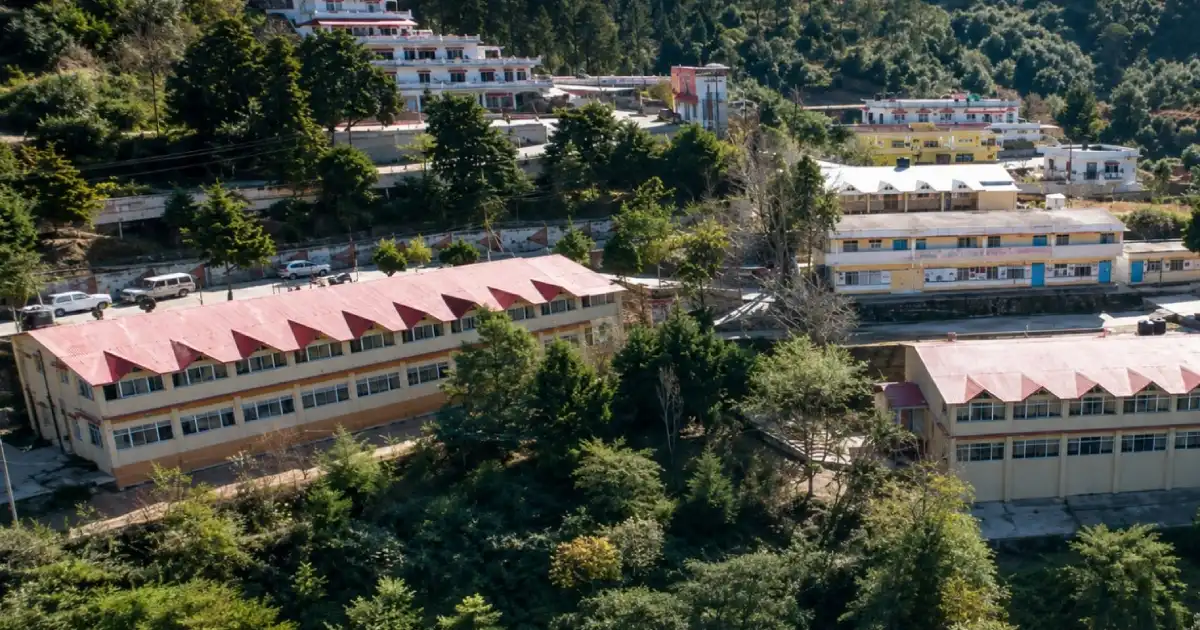
Students should check current courses, admissions, fees, and eligibility directly with each institution.
Administrative Structure
The District Magistrate heads the district administration from the Collectorate at New Tehri; for the current officer and contact details, use the district website. Revenue administration operates through tehsils, while development blocks support local planning and programme implementation.
The district has nine development blocks: Bhilangana, Chamba, Devprayag, Jakhnidhar, Jaunpur, Kirtinagar, Narendranagar, Pratapnagar and Thauldhar. Tehsils include Tehri, Ghansali, Devprayag, Narendranagar, Pratapnagar, Jakhnidhar and Dhanaulti; check current district notices, as administrative units have been added over time.
Urban bodies include the Nagar Palika Parishad at New Tehri and municipalities at Narendranagar, Chamba, Devprayag and Muni Ki Reti. For a certificate or local service, first identify the relevant village, block, tehsil or municipal office. The district falls under the Tehri Garhwal Lok Sabha constituency.
Important Towns and Settlements
- New Tehri: District headquarters and the main administrative centre.
- Narendranagar: A town near Rishikesh, once the capital of Maharaja Narendra Shah.
- Kirtinagar and Pratapnagar: Towns that served as capitals under earlier kings.
- Devprayag: The sacred confluence town on the southern edge of the district.
- Chamba: A junction town on the main routes of the district.
- Ghansali: A tehsil headquarters in the Bhilangana valley, on the way to Ghuttu.
- Dhanaulti and Kanatal: Hill stations on the Mussoorie side.
- Jakhnidhar and Muni Ki Reti: Block and municipal centres on different sides of the district.
These places lie along different travel corridors. Select accommodation and transport according to the destination you intend to explore.
Nature and Biodiversity
Tehri Garhwal’s landscape ranges from river valleys and the large Tehri reservoir to alpine forests of deodar, rhododendron and oak, high meadows and glaciers. The Bhagirathi, Bhilangana and Alaknanda shape its valleys, and the Tehri Lake is a prominent feature of the central part of the district.
Dhanaulti is known for its forests and eco-parks, and the trails around Surkanda Devi, Chandrabadni and Kunjapuri pass through hill forest. Birdlife and wildlife sightings are never guaranteed. Follow forest rules, take your waste back, and avoid disturbing the lake shore and high-altitude meadows.
High-altitude treks to Khatling Glacier and Sahastra Tal are demanding and may need permits and experienced guides. Check the relevant forest authority’s arrangements before you plan an excursion.
Culture, Traditions, Festivals and Fairs
Tehri Garhwal’s culture is rooted in Garhwali traditions, and Garhwali is the first language of most residents. The legacy of the Tehri kings, village shrines, and temple fairs remains part of community life.
The Surkanda Devi temple is known for its Ganga Dussehra fair, and hilltop temples such as Chandrabadni and Kunjapuri draw crowds on festival days, especially during Navratri. The Tehri Lake Festival brings adventure sports, tourism events, and cultural programmes to Koti Colony; the 2026 edition ran from 7 to 9 March.
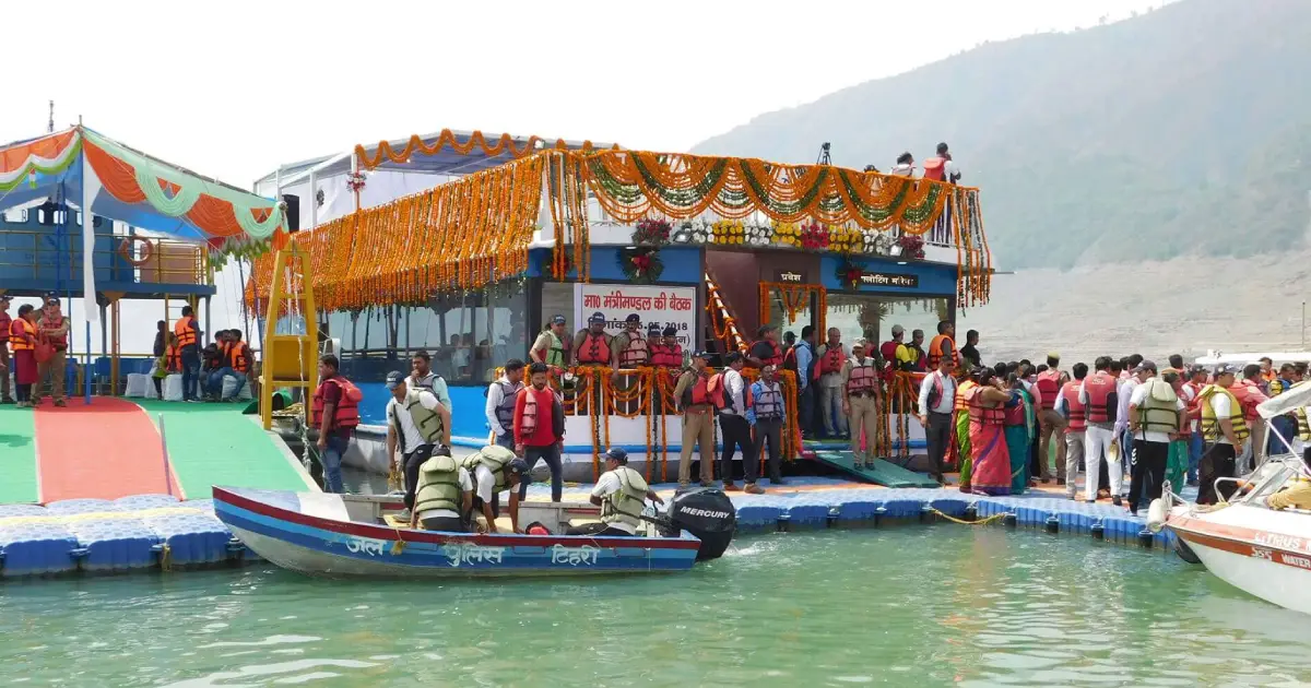
Dates and programmes differ from year to year. Village celebrations also vary across the district, so ask local hosts about the customs of the place you are visiting rather than assuming every community follows the same practice.
Local Food
Food in Tehri Garhwal reflects the mountain cuisine of Garhwal and locally available crops. Depending on the household and season, meals may feature mandua, jhangora, pulses, leafy vegetables, and simple home-style preparations.

Regional dishes to ask about include kafuli, phaanu and chainsoo. These belong to Uttarakhand’s broader culinary tradition and may not appear on every restaurant menu. Hill-station and lake-side eateries mostly serve North Indian and tourist-friendly food.
Homestays can be a good place to learn about household food traditions. Confirm meals in advance, especially if you have dietary requirements or will arrive late.
Livelihoods and the Local Economy
Agriculture on terraced fields and livestock support many rural households. The Tehri Hydro Power Complex and its operator, THDC India Limited, are major sources of employment around New Tehri, and the dam and lake support a growing tourism economy.
Hill-station tourism, trekking, water sports and pilgrimage create seasonal work in accommodation, transport, guiding and food services. Government services and education also employ in the main towns.
Visitors can support the local economy through locally operated stays, produce and skilled services. Young people considering work in tourism, adventure or water sports should enquire about training, qualifications and the operating requirements for the activity they want to pursue.
Healthcare, District Administration and Emergency Contacts
Emergency assistance: 112 | Ambulance: 108 | Disaster helpline: 1077.
New Tehri and the main towns have government hospitals and clinics, and larger hospitals are in Rishikesh and Dehradun. Facilities in remote hill areas are fewer and farther apart, so plan travel and medical needs, especially for treks and winter travel. For district office and department numbers, use the directory on the District Administration website.
Contacts and facilities were reviewed on 12 October 2026; telephone availability has not been tested. Use 112 for immediate emergencies, and take extra care near the lake and rivers.
Frequently Asked Questions
Which state is Tehri Garhwal in?
Tehri Garhwal is in Uttarakhand, in the Garhwal division.
Where is Tehri Garhwal located?
It lies in western Garhwal in northern Uttarakhand, bordered by Uttarkashi to the north, Rudraprayag to the east, Pauri Garhwal to the south and Dehradun to the west.
What is the headquarters of Tehri Garhwal district?
The district headquarters is New Tehri, a planned town built after the old Tehri town was submerged by the Tehri Dam reservoir.
What is New Tehri?
New Tehri is the district headquarters of Tehri Garhwal, at an elevation of roughly 1,900 metres. Its PIN code is 249001.
What are the tehsils of Tehri Garhwal district?
Tehsils include Tehri, Ghansali, Devprayag, Narendranagar, Pratapnagar, Jakhnidhar and Dhanaulti. More have been added in recent years, so check the district website for the current list.
What are the blocks of Tehri Garhwal district?
There are nine blocks: Bhilangana, Chamba, Devprayag, Jakhnidhar, Jaunpur, Kirtinagar, Narendranagar, Pratapnagar, and Thauldhar.
What is the population of Tehri Garhwal district?
The Census 2011 district total is 6,18,931. It should not be presented as a current estimate.
What is the history of Tehri Garhwal district?
Tehri Garhwal was a princely state from 1815 to 1949, ruled by the Shah dynasty. It merged into Uttar Pradesh in 1949 and became a district, and Uttarkashi and Rudraprayag were later carved out of it.
What is Tehri Garhwal district famous for?
It is known for the Tehri Dam and Lake, New Tehri, Dhanaulti, Kanatal, Surkanda Devi, Devprayag, water sports, and trekking routes.
Where can I find the Tehri Garhwal district villages list?
Village lists are available in the Census of India village directory and on the district administration website. Use those sources for the current list rather than relying on a summary.
What is the Tehri Garhwal PIN code?
The PIN code of New Tehri is 249001. Other places have their own codes; for example, Narendranagar 249175, Ghansali 249155, and Chamba 249145.
Who is the DM of Tehri Garhwal?
The District Magistrate heads the district administration. Officers change with postings, so check the district website for the current DM and contact details.
Is Chamba in Tehri Garhwal district?
Yes. Chamba in Uttarakhand is a block and town in Tehri Garhwal district. It is different from Chamba in Himachal Pradesh.
Is Ghansali in Tehri Garhwal district?
Yes. Ghansali is a tehsil in Tehri Garhwal district, in the Bhilangana valley.
Is Dhanaulti in Tehri Garhwal district?
Yes. Dhanaulti is a tehsil and hill station in Tehri Garhwal district, about 40 km from New Tehri.
Is Devprayag in Tehri Garhwal district?
Yes. Devprayag is a tehsil and block in Tehri Garhwal district, where the Alaknanda and Bhagirathi meet to form the Ganga.
What is the Tehri Dam and how tall is it?
The Tehri Dam, also called Tehri Bandh, is a 260.5-metre earth and rockfill dam on the Bhagirathi. It is the tallest dam in India and part of a 2,400 MW hydropower complex.
What is Tehri Lake?
Tehri Lake, or the Tehri Dam lake, is the reservoir created by the dam. It submerged the old Tehri town and is now a popular spot for water sports and tourism.
What water sports are available in Tehri Lake?
Activities include boating, jet skiing, banana boat rides, kayaking, canoeing, and water skiing, and the Tehri Lake Festival has featured parasailing and scuba diving. Availability depends on the season, weather, and licensed operators.
What are the places to visit in Tehri Garhwal?
Popular places include the Tehri Dam and Lake, New Tehri, Dhanaulti, Surkanda Devi, Kanatal, Devprayag, Kunjapuri, Chandrabadni, Nag Tibba and the Ghuttu–Khatling treks.
What is the weather in New Tehri?
New Tehri is a hill town at roughly 1,900 metres. Winters are cold, summers are mild, and the monsoon brings heavy rain. Higher places such as Dhanaulti and Kanatal are colder. Check the live forecast for your dates.
What is the best time to visit Tehri Garhwal?
March to June and September to November are generally the most comfortable. Winter brings snow to the higher areas, and the monsoon can disrupt roads.
How to reach Tehri Garhwal?
The nearest airport is Jolly Grant in Dehradun (about 76 km from New Tehri), and the nearest railway station is Rishikesh (about 71 km). The rest of the journey is by road.
What sports are popular in Tehri Garhwal?
Water sports such as kayaking, canoeing, and rowing at Tehri Lake, along with trekking and mountaineering, are the district’s best-known sports.
Which sportspersons are from Tehri Garhwal?
Mountaineers Ajay Kothiyal and Arvind Raturi are from Tehri Garhwal district.
Where should I check current openings and permissions?
Use district administration notices, official tourism information, THDC announcements for the dam and lake, and the relevant forest authority.
Useful Official Links
District Administration | Tehri Lake | THDC Tehri Hydro Power Complex | Uttarakhand Tourism | Sri Dev Suman Uttarakhand University | Department of Sports | Disaster Management | Char Dham Registration
Population: Census 2011. Area, blocks and history: Tehri Garhwal district administration and district records. Tehri Dam: THDC India Limited. Water sports and National Games: THDC and published event reports. Elevations and distances: published sources and may vary. Information reviewed: 12 October 2026.
One Response