

Introduction
Udham Singh Nagar district is in the Terai region of Uttarakhand, within the Kumaon division. Known for fertile agricultural land, industrial development, religious heritage, and reservoirs, the district includes important towns such as Rudrapur, Kashipur, Kichha, Jaspur, Bazpur, Gadarpur, Sitarganj, and Khatima. Rudrapur is the district headquarters.
Udham Singh Nagar is one of the 13 districts of Uttarakhand. It was carved out of the former Nainital district in October 1995 and named after freedom fighter Shaheed Udham Singh. The district is often described as the “food bowl of Uttarakhand,” reflecting its agricultural importance.
This guide covers the district map and location, administrative units, population, history, famous places, travel routes, weather, sports, education, and public services. The landscape is largely plains and Terai countryside rather than the high Himalayan terrain associated with many other Uttarakhand destinations.
District at a Glance
- State: Uttarakhand; division: Kumaon.
- Headquarters: Rudrapur.
- Area: About 2,542 square kilometres, as shown on the district administration website.
- Population: 16,48,902 in 2011. This is a historical census figure, not a current estimate. Some district web summaries display 16,48,302; use the Census 2011 district handbook for demographic citations and note discrepancies rather than combining figures.
- Literacy: 73.10% in Census 2011.
- Sex ratio: 920 females per 1,000 males in Census 2011.
- Tehsils: The district administration currently lists 8: Khatima, Sitarganj, Kichha, Rudrapur, Gadarpur, Bazpur, Kashipur, and Jaspur. Some district summary pages report 9; verify the current revenue notification before using a count in official paperwork.
- Development blocks: 7-Jaspur, Kashipur, Bazpur, Gadarpur, Rudrapur, Sitarganj and Khatima.
- Villages: The district administrative page reports 658 villages; village totals vary by dataset and administrative classification.
- Urban local bodies: The district website lists two municipal corporations, six municipal councils and six nagar panchayats.
- Languages: Hindi, Punjabi, Bengali, Urdu, and Kumaoni are among the languages spoken.
- Known for: Agriculture, SIDCUL industrial areas, Pantnagar University, Nanakmatta Sahib, Nanak Sagar, temples and lakes.
Administrative counts can differ between district summary pages, current revenue arrangements, and older census records. For certificates and jurisdiction, follow the latest district notification.
Location and Geography
Udham Singh Nagar lies in the southeastern part of Uttarakhand, in the fertile Terai belt at the Himalayan foothills. It borders Nainital and Champawat districts toward the north and northeast, Uttar Pradesh to the south and west, and Nepal toward the east. The Sharda River forms part of the India-Nepal boundary in this region. Refer to an official district map for exact boundary lines.
The district’s relatively flat terrain supports agriculture, transport corridors, settlements and industrial estates. Rivers, canals and reservoirs contribute to irrigation. The weather and local landscape differ from Uttarakhand’s higher-altitude hill districts.
History of Udham Singh Nagar District
The area historically formed part of the wider Kumaon and Terai region. The district administration notes that Rudrapur’s history is associated with King Rudra Chandra and a settlement that developed in the sixteenth century.
Udham Singh Nagar was part of Nainital district before becoming a separate district in October 1995. It was named in memory of Shaheed Udham Singh, the Indian freedom fighter remembered for assassinating Michael O’Dwyer in London in 1940, in retaliation for the Jallianwala Bagh massacre. The district’s more recent development has been shaped by agriculture, migration, industry, transport links, and educational institutions.
Famous Places to Visit in Udham Singh Nagar District
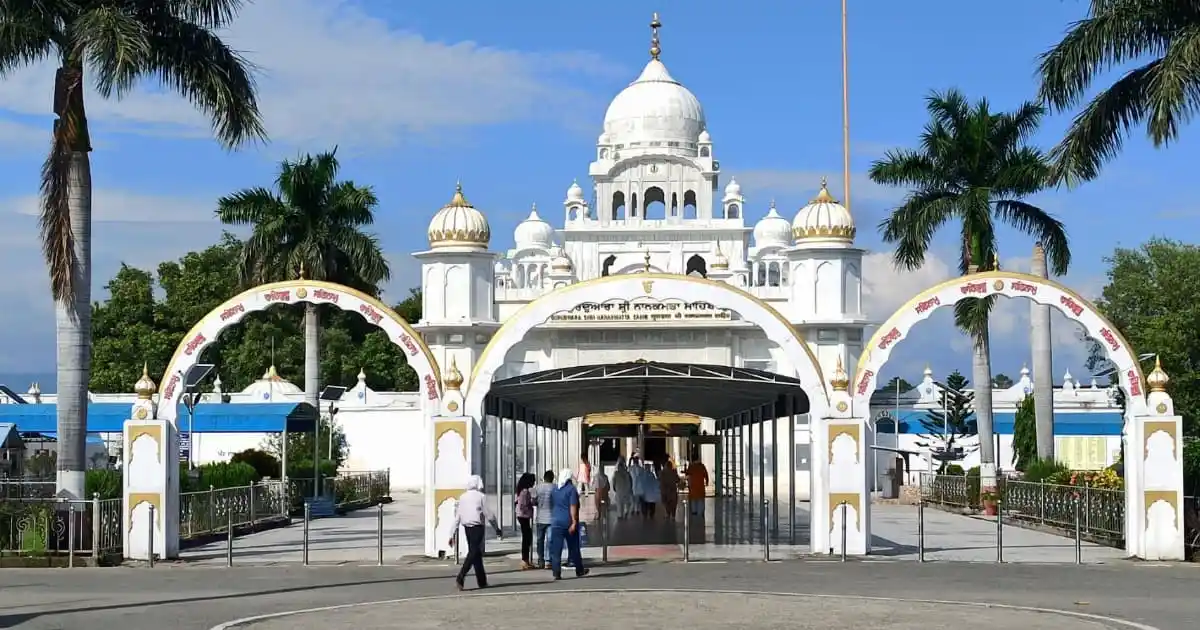
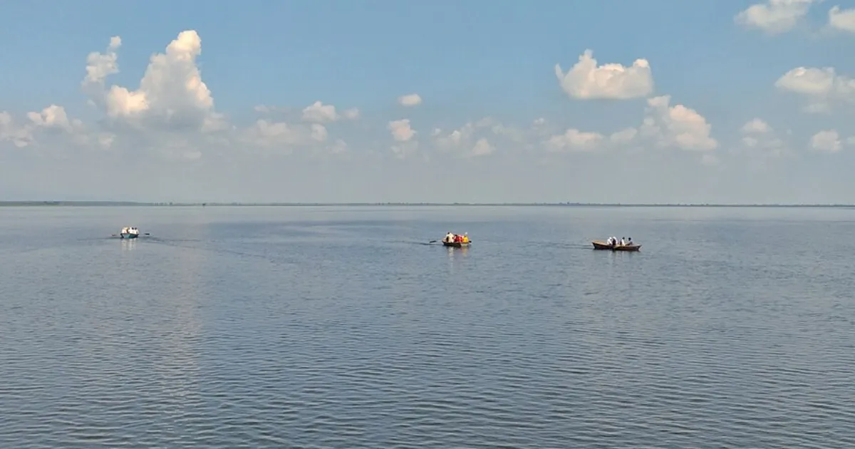
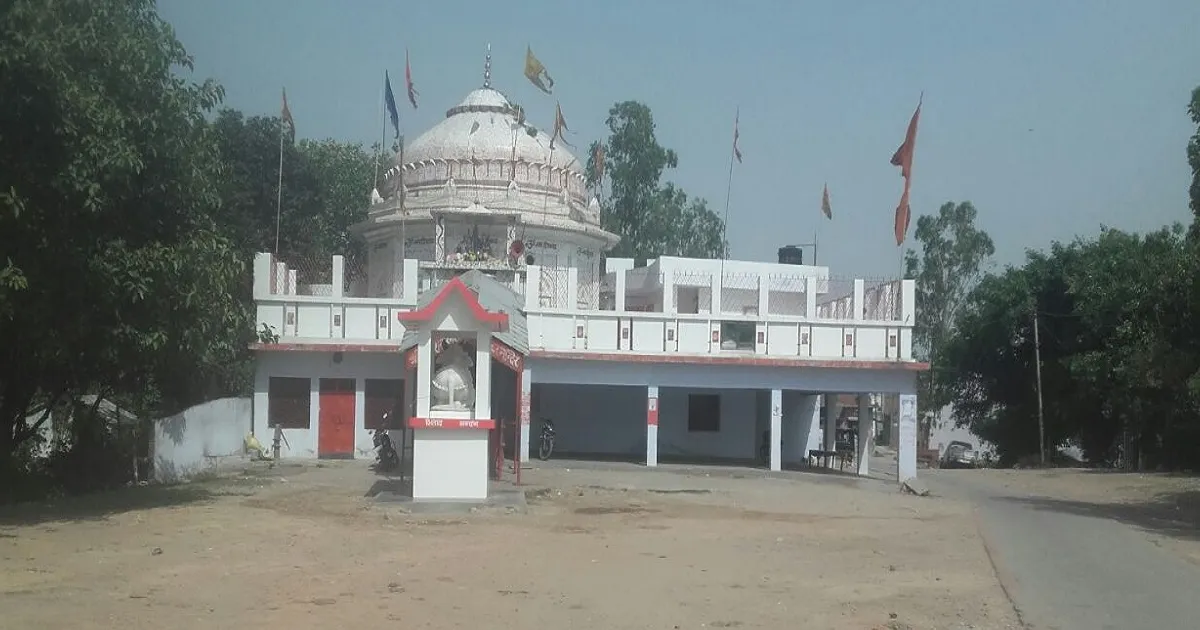
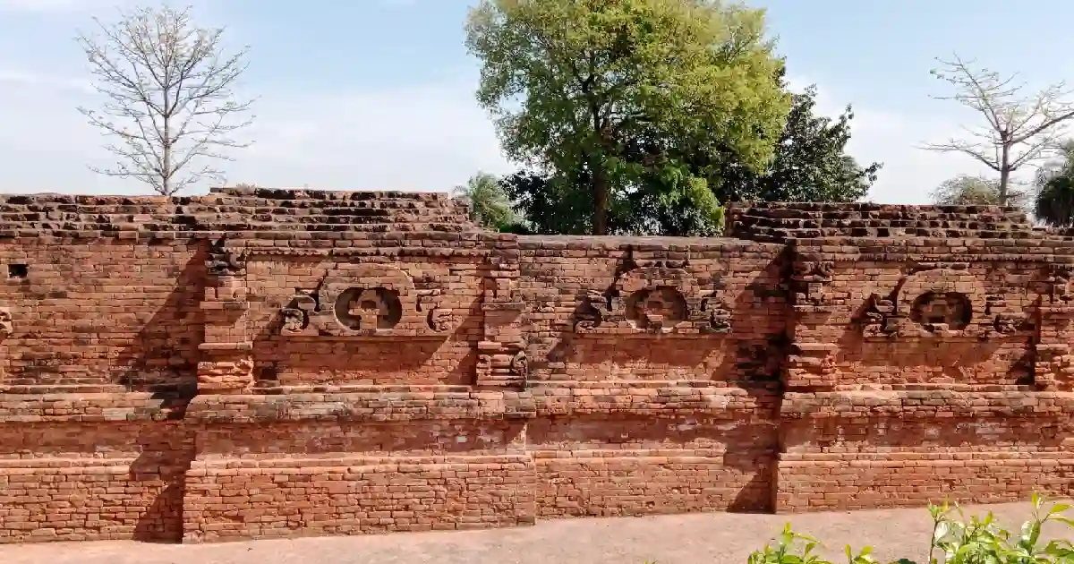


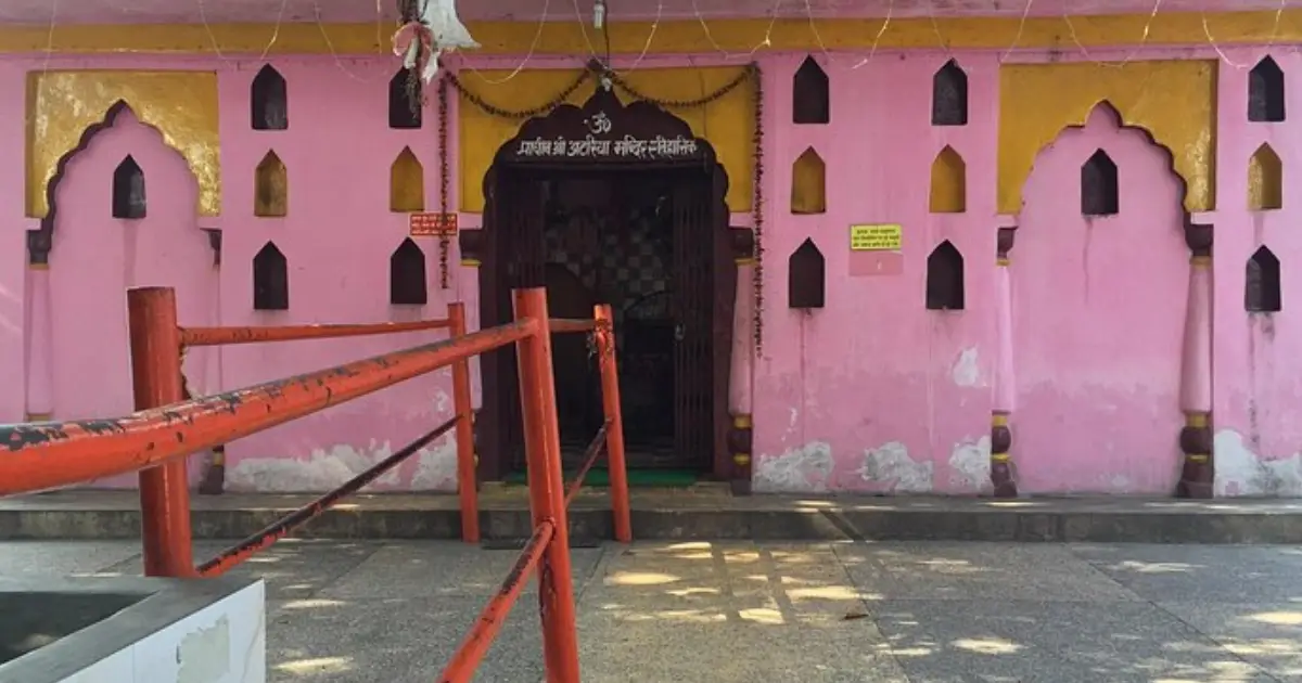
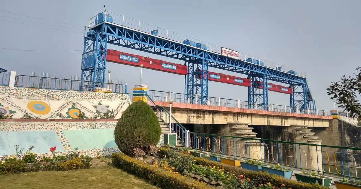
Place names and facilities can be confused in online listings. Check the local destination and route before travelling, particularly for dams and reservoirs where access may be restricted.
Religious and Heritage Sites
- Gurudwara Nanakmatta Sahib: A prominent Sikh shrine connected with traditions about Guru Nanak Dev Ji’s visit.
- Chaiti Devi Temple: A popular shrine near Kashipur, especially during Navratri.
- Moteshwar Mahadev Temple: A respected Shiva temple in Kashipur.
- Atariya Devi Temple: A temple near Rudrapur associated with a seasonal fair.
- Drona Sagar: A historic lake linked with local religious tradition.
- Panch Mandir: A temple complex in Rudrapur.
These are active places of worship. Dress respectfully, follow site instructions, and allow extra time during festival days when crowds and traffic may increase.
Nanakmatta, Nanak Sagar and the District’s Reservoirs
Nanakmatta is a pilgrimage town known for Gurudwara Sri Nanak Matta Sahib and Nanak Sagar. The gurdwara is associated with the tradition that Guru Nanak Dev Ji visited the area on his way toward Kailash. Nanak Sagar is a reservoir that attracts visitors for its open water views and winter birdwatching.
The district also has water bodies and dams including Baur, Haripura, Dhaura, Tumaria, and Baigul. Their primary roles include water management and irrigation; a reservoir should not automatically be treated as a public swimming or boating venue. Confirm permitted activities and safety conditions locally.
How to Reach Udham Singh Nagar
By air: Pantnagar Airport serves the district and is the closest airport for Rudrapur and nearby towns. Flight routes and frequency can change, so check the airline schedule. From the airport, continue by taxi or road transport.
By rail: Rudrapur City, Kashipur, Kichha, Bazpur, and other stations serve different parts of the district. Choose the station according to your destination; Kashipur and Khatima are not interchangeable arrival points.
By road: Rudrapur, Kashipur, Khatima, Sitarganj, Jaspur and other towns are connected by road to Uttarakhand and Uttar Pradesh destinations. Bus and taxi options depend on route and time of day.
Travel planning: For Nanakmatta, the tourism information lists Khatima as a nearby railway station, while Pantnagar is the nearest airport cited in destination material. Check live navigation for exact distance and journey time, as routes and traffic conditions vary.
Weather and Best Time to Visit
Udham Singh Nagar has a Terai and plains climate. Summers can be hot, the monsoon brings humidity and heavy rain, and winters are generally cooler with occasional fog. Conditions vary by town and date; this district does not have the same temperature profile as high-altitude Nainital or Mukteshwar.
Live weather and temperature for the Rudrapur area. Forecast conditions can differ across the district. For official alerts and forecasts, consult the India Meteorological Department.
- Winter (November to February): Often more comfortable for sightseeing, though mornings may be foggy or chilly.
- Spring (February to March): A practical season for temples, town visits, and outdoor stops, depending on the forecast.
- Summer (April to June): Can be hot; plan outdoor visits for morning or evening and carry water.
- Monsoon (July to September): Rain can affect roads and reservoir conditions. Check weather warnings and local access.
- Autumn (October): Often suitable for visiting, but daily conditions still vary.
For many visitors, October to March is a useful planning window. Religious visits can take place year-round; festival calendars, heat, rain and fog should guide the final date.
Udham Singh Nagar District Map and Location
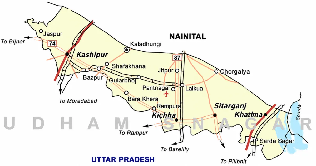
Udham Singh Nagar lies in southeastern Uttarakhand along the Terai plains. Rudrapur is the district headquarters, while Kashipur, Khatima, Sitarganj, Jaspur, Bazpur, Gadarpur and Kichha are important administrative and urban centres.
- North: Nainital district and adjoining Kumaon foothill areas.
- Northeast: Champawat district.
- East: Nepal, with the Sharda River forming part of the boundary.
- South and west: Districts of Uttar Pradesh.
Boundary descriptions are simplified. Refer to the district administration’s map for exact boundaries and jurisdiction. Read our guides to Nainital and Champawat.
Accommodation and Where to Stay
- Rudrapur: A practical base for district offices, business, shopping, transport, and nearby attractions.
- Kashipur: Useful for temples, local heritage spots, and the western part of the district.
- Khatima or Sitarganj: Consider these towns for Nanakmatta and destinations toward the eastern side.
- Pantnagar: Convenient for university-related visits or airport access, depending on accommodation availability.
Confirm the exact location, parking, check-in time, transport options, and cancellation terms before booking. During major fairs or holidays, reserve ahead.
Suggested Itineraries
These are sample ideas, not confirmed transport schedules.
- One day in Rudrapur: Atariya Devi Temple, local city attractions and Lake Paradise, subject to current access.
- Kashipur heritage day: Drona Sagar, Giri Tal, Chaiti Devi Temple and Moteshwar Mahadev Temple.
- Nanakmatta pilgrimage trip: Visit Gurudwara Nanakmatta Sahib and Nanak Sagar. Check the reservoir access and local travel options in advance.
- District overview (2-3 days): Choose one cluster around Rudrapur, another around Kashipur, and a separate journey toward Nanakmatta/Khatima instead of crisscrossing the district.
Distances and journey times depend on your starting point, road works, and traffic. Use a navigation app on the travel date.
Sports in Udham Singh Nagar District
Sports participation across Udham Singh Nagar includes cricket, football, athletics, badminton, volleyball, kabaddi and school-level competitions. The district’s towns and educational institutions provide venues for community and organised sports, while district and state programmes may offer coaching, trials or competition pathways.
Rudrapur and Kashipur are important urban centres for finding sports clubs, schools and facilities. Do not assume that a listed ground offers coaching in every discipline or accepts walk-ins. Availability, coaches, age groups and selection schedules should be confirmed directly with the facility or the District Sports Office.
Outdoor Activities and Nature
The district’s lakes and reservoirs, including Nanak Sagar and the Haripura-Baur area, can offer scenic outings and birdwatching opportunities. Winter may bring migratory birds to some wetlands. Activities such as boating or angling are location-specific and must be confirmed with local authorities or approved operators.
Avoid swimming in dams, canals and reservoirs unless an area is expressly designated and supervised for it. Water levels, currents, restricted zones and operational activity can make these locations hazardous.
Sports Facilities, Training and Athlete Opportunities
For organised coaching, school competitions, trials and district-level sports programmes, check with the Uttarakhand Department of Sports and the relevant district office. Ask about the sport, age category, trial dates, eligibility, fees (if any), required documents, and whether registration is open.
Students can also explore sports programmes at schools, colleges and universities. Training opportunities are not guaranteed by a facility’s presence; confirm the current programme and coach availability before travelling or enrolling.
Sportspersons from Udham Singh Nagar District
A reliable athlete profile should state the person’s verified birthplace or documented district connection, sport, and achievements. Do not label an athlete as “from Udham Singh Nagar” based only on team affiliation, residence at one point, or an unverified online biography.
This section can be expanded with athletes whose birthplaces and sporting records are supported by dependable profiles, federation records or credible reporting. For a broader list, see famous sportspersons from Uttarakhand.
Education, Research and Industry
Udham Singh Nagar is an important agricultural, industrial and education centre. Notable institutions and development anchors include:
- G. B. Pant University of Agriculture and Technology, Pantnagar: A major institution for agricultural education, research and technology.
- SIDCUL industrial areas: Industrial estates contribute to manufacturing and employment in the district.
- Colleges and training institutes: Towns across the district have educational institutions; course offerings and admissions vary.
Students should check each institution’s official website for current admissions, programmes, fees, and eligibility. Job seekers should use official employer and government recruitment notices.
Administrative Structure
The District Magistrate heads the district administration. The official district website currently identifies Mr. Nitin Singh Bhadauria as District Magistrate; postings can change, so verify the latest name and contact information on the district administration website.
Tehsils: The district administrative bodies page lists Khatima, Sitarganj, Kichha, Rudrapur, Gadarpur, Bazpur, Kashipur, and Jaspur. Some pages report nine tehsils, so check the current revenue order if an exact legal/administrative count matters.
Development blocks (7): Jaspur, Kashipur, Bazpur, Gadarpur, Rudrapur, Sitarganj and Khatima.
The district portal reports 27 Nyaya Panchayats and 658 villages. Urban local bodies include municipal corporations, municipal councils and nagar panchayats. Administrative numbers may change; for a local certificate or service, identify the village or ward first, then confirm the correct tehsil, block or municipal office.
Important Towns and Settlements
- Rudrapur: District headquarters and an important commercial and industrial centre.
- Kashipur: A major town with heritage sites, temples, education and industry.
- Kichha: A town and tehsil known for its agricultural and commercial setting.
- Jaspur: An important urban centre in the western part of the district.
- Bazpur: A town connected with surrounding agricultural communities.
- Gadarpur: A market town and administrative centre.
- Sitarganj: A town serving the central-eastern part of the district.
- Khatima: A town toward the Nepal border region and a practical access point for Nanakmatta.
- Pantnagar: Known for its university and airport.
Use the settlement name and PIN code together when sending parcels or completing forms, as nearby localities may use different postal codes.
Nature, Agriculture and Water Resources
The district’s fertile Terai soils and irrigation network support crops such as rice, wheat and sugarcane, alongside fruits and vegetables. Water resources and reservoirs are significant to agriculture and local livelihoods. The same waterways and wetlands can support birdlife, particularly during seasonal migrations.
Responsible visits matter: avoid littering, respect protected and operational areas, and follow local instructions around reservoirs and canals. Do not approach wildlife or enter restricted water infrastructure.
Culture, Traditions, Festivals and Fairs
Udham Singh Nagar has a diverse population and a mix of cultural traditions. Hindi and Punjabi are widely used, alongside Bengali, Urdu, Kumaoni and other languages. Migration and agriculture have shaped the district’s communities and food culture.
Religious occasions include gatherings at Nanakmatta Sahib and fairs at shrines such as Chaiti Devi and Atariya Temple. Festival dates, processions and crowd-control arrangements can vary. Check local announcements before planning a visit during major events.
Local Food
The district’s food reflects Kumaoni, Terai, Punjabi and wider North Indian influences. Depending on the locality, visitors may find seasonal vegetables, rice and wheat dishes, lentils, dairy foods, and regional snacks alongside familiar market-town meals. Traditional regional dishes associated with Kumaoni cuisine, such as Aloo ke Gutke, Bhatt ki Churkani, Ras, Baadi and Arsa, may also be found in some parts of the district, although availability varies by locality.

Food options vary by town and restaurant. Ask residents for regional specialties and check ingredients if you have dietary restrictions. In larger centres such as Rudrapur and Kashipur, dining choices are generally broader than in smaller settlements.
Livelihoods and the Local Economy
Agriculture and industry are central to the district’s economy. The region produces food grains, sugarcane, fruits and vegetables, while industrial areas support manufacturing, logistics and related services. Rudrapur, Kashipur, Pantnagar and nearby industrial zones contribute to trade, employment and education.
The district’s markets, transport services, educational institutions and public-sector offices also support local livelihoods. Tourism is present, especially around religious destinations and reservoirs, but it should not be mistaken for the district’s only or primary economic identity.
Healthcare, District Administration and Emergency Contacts
Emergency assistance: Dial 112 for police emergency response; ambulance services may be reached through 108 or local arrangements. Confirm the appropriate current number and service coverage for your location.
Rudrapur and Kashipur are among the larger service centres. Healthcare access and specialist availability differ across the district, so confirm facility hours and services before travelling. For government department contacts, use the directory on the district website.
Contact details and office holders can change. Use official sources for current helplines, office timings, and public notices.
Frequently Asked Questions
Which state is Udham Singh Nagar in?
Udham Singh Nagar is a district in Uttarakhand, India, in the Kumaon division.
Where is Udham Singh Nagar district located?
It lies in the Terai region of southeastern Uttarakhand, bordering Uttar Pradesh and Nepal and adjoining districts including Nainital and Champawat.
What is the headquarters of Udham Singh Nagar district?
Rudrapur is the district headquarters.
What is Udham Singh Nagar district famous for?
The district is known for agriculture, industrial areas, G. B. Pant University at Pantnagar, Nanakmatta Sahib, Nanak Sagar, temples and lakes.
What is the area of Udham Singh Nagar district?
The district administration lists an area of about 2,542 square kilometres.
What is the population of Udham Singh Nagar district?
The Census 2011 population was 16,48,902. Treat this as a historical census count, not a current population estimate. Some district summary material displays a slightly different figure.
What are the tehsils of Udham Singh Nagar district?
The district’s administrative bodies page lists Khatima, Sitarganj, Kichha, Rudrapur, Gadarpur, Bazpur, Kashipur and Jaspur. Other district summaries show a count of nine; verify the latest official list.
What are the blocks of Udham Singh Nagar district?
The seven development blocks listed by the district administration are Jaspur, Kashipur, Bazpur, Gadarpur, Rudrapur, Sitarganj and Khatima.
What is the PIN code of Udham Singh Nagar?
There is no single PIN code for the whole district. PIN codes differ by post office and locality. Use India Post’s official lookup for the exact address.
What is the PIN code of Rudrapur, Udham Singh Nagar?
Rudrapur localities may use different postal codes. Verify the exact PIN through India Post using the locality or post office name before mailing.
Who is the DM of Udham Singh Nagar?
The district website currently names Mr. Nitin Singh Bhadauria as District Magistrate. Check the official district portal for the latest posting.
What is the weather in Udham Singh Nagar?
The district generally has a Terai climate, with hot summers, a rainy monsoon, and cooler winters. Use the live forecast above for conditions on your dates.
What is the best time to visit Udham Singh Nagar?
October to March is often a comfortable period for sightseeing. Check local weather and event calendars before choosing travel dates.
Is Rudrapur in Udham Singh Nagar district?
Yes. Rudrapur is the district headquarters.
Is Kashipur in Udham Singh Nagar district?
Yes. Kashipur is an important city and administrative centre in the district.
Is Haldwani in Udham Singh Nagar district?
No. Haldwani is in Nainital district.
Is Ramnagar in Udham Singh Nagar district?
No. Ramnagar is in Nainital district.
Is Nanak Sagar Dam in Udham Singh Nagar district?
Yes. Nanak Sagar is near Nanakmatta in Udham Singh Nagar district.
What are the best places to visit in Udham Singh Nagar?
Popular places include Nanakmatta Sahib, Nanak Sagar, Chaiti Devi Temple, Giri Tal, Drona Sagar, Atariya Temple, Lake Paradise, and the Haripura-Baur reservoir area.
What is Nanakmatta famous for?
Nanakmatta is best known for Gurudwara Sri Nanak Matta Sahib and the nearby Nanak Sagar reservoir.
Where is Giri Sarovar?
Giri Tal, also called Giri Sarovar, is a tourist spot in Kashipur.
Where is Chaiti Devi Temple?
Chaiti Devi Temple is on the Kashipur-Bazpur route, approximately 2.5 km from Kashipur bus stand, according to the district tourism page.
Is Pantnagar in Udham Singh Nagar district?
Yes. Pantnagar is in the district and is known for G. B. Pant University of Agriculture and Technology and Pantnagar Airport.
How can I reach Udham Singh Nagar?
The district can be reached by air through Pantnagar Airport, by rail through stations serving Rudrapur, Kashipur, and other towns, and by road. Select your arrival point based on the town you plan to visit.
What sports are popular in Udham Singh Nagar?
Cricket, football, athletics, badminton, volleyball, and kabaddi are played through schools, clubs, and competitions. Facilities and coaching vary by location.
Which sportspersons are from Udham Singh Nagar?
Include only athletes whose birthplace or district connection can be verified with credible biographical or sports records. Avoid inferring district origin from team affiliation alone.
Why is the district named Shaheed Udham Singh Nagar?
The district was named in memory of freedom fighter Shaheed Udham Singh.
Useful Official Links
District Administration | District Administrative Setup | Subdivisions and Blocks | Tourist Places | Uttarakhand Tourism | Census of India | Department of Sports | India Meteorological Department | India Post
Population, literacy and sex ratio: Census 2011 references. Administrative setup, current office-holder, and listed units: Udham Singh Nagar district administration. Tourism information: district tourism pages and Uttarakhand Tourism. Administrative totals and postal details should be checked against current official records. Weather is dynamic; consult live forecasts before travel.