Introduction
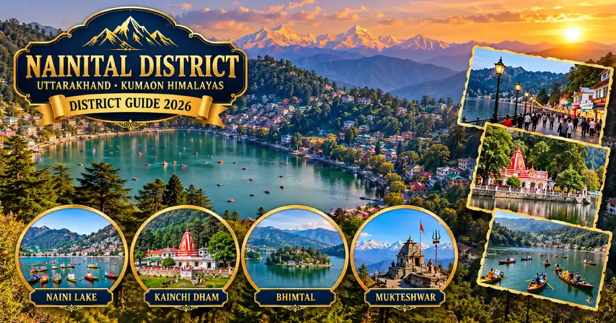
Nainital district is in the Kumaon division of Uttarakhand. It is best known for Naini Lake and Nainital town, the lakes of Bhimtal, Sattal and Naukuchiatal, the Kainchi Dham ashram, the hill village of Mukteshwar, Jim Corbett’s home at Kaladhungi, and Haldwani, the largest city of Kumaon. The district is often called the “Lake District of India”, and its headquarters is Nainital town, which is also the divisional headquarters of Kumaon.
Nainital is one of the 13 districts of Uttarakhand. It stretches from the forested foothills near Kaladhungi and Ramnagar to hill stations above 2,000 metres, so one district covers plains-edge towns, lakes, orchards and mountain viewpoints. The High Court of Uttarakhand and the Raj Bhavan are in Nainital town, and the town is described as the judicial capital of the state.
This guide covers the district’s history, map and location, tehsils and blocks, places to visit, how to reach, weather, sports, education, culture and public services. Haldwani, Bhimtal, Ramnagar, Kainchi Dham, Mukteshwar, Ramgarh, Kaladhungi and Lalkuan are all in Nainital district.
District at a Glance
- State: Uttarakhand; division: Kumaon.
- Headquarters: Nainital, at an elevation of about 2,084 metres according to Wikipedia (published figures vary by source).
- Area: About 3,860 square kilometres is the commonly cited figure. An audit report gives 3,853 square kilometres, and some census-based tables use a larger figure of about 4,251 square kilometres, so check the district profile for the number you need.
- Population: 9,54,605, according to the 2011 Census. This is a historical census figure, not a current estimate. It was the fourth most populous district of Uttarakhand.
- Sex ratio (Census 2011): 934 females per 1,000 males; literacy: about 83.9 per cent; urban share: about 39 per cent.
- Religion (Census 2011): About 84.8 per cent Hindu, 12.7 per cent Muslim and 1.8 per cent Sikh.
- Languages (Census 2011, first language): Kumaoni about 48 per cent, Hindi about 39 per cent, Urdu about 6.6 per cent, Punjabi about 2.1 per cent and Garhwali about 1.6 per cent.
- Tehsils: The district had eight tehsils at the time of the 2013 audit report and the 2011 Census tables: Nainital, Haldwani, Ramnagar, Kaladhungi, Lalkuan, Dhari, Betalghat and Kosya Kutauli. Published lists now include more units, such as Kainchi Dham, Khansyun, Okhalkanda and Ramgarh. Check the district website for the current list.
- Development blocks (8): Betalghat, Bhimtal, Dhari, Haldwani, Kotabagh, Okhalkanda, Ramgarh and Ramnagar.
- Assembly constituencies (6): Lalkuan, Bhimtal, Nainital (SC), Haldwani, Kaladhungi and Ramnagar.
- PIN code: 263001 and 263002 (Nainital town); STD code: 05942 (Nainital), 05946 (Haldwani); vehicle registration: UK 04.
- Main attractions: Naini Lake, Naina Devi Temple, Naina Peak, Tiffin Top, Bhimtal, Sattal, Naukuchiatal, Kainchi Dham, Mukteshwar, Kilbury, Ghorakhal, Jim Corbett Museum at Kaladhungi and the Ramnagar gateway to Corbett.
Location and Geography
Nainital district lies in the Kumaon foothills of the outer Himalayas. It is bounded by Almora district to the north and Udham Singh Nagar district to the south. Champawat, Pauri Garhwal and Uttar Pradesh lie on its other sides, and the compass directions are approximate, so use an official map for exact boundaries. You can read about neighbouring districts in our guides to Almora and Champawat.
The landscape changes quickly with height. The southern part around Kaladhungi, Lalkuan and Ramnagar is low and forested, with Haldwani at the foot of the hills. Further north, the road climbs through Bhowali and Bhimtal to ridges above 2,000 metres at Nainital, Mukteshwar and Kilbury. The Kosi River forms part of the boundary between Almora and Nainital districts before entering Nainital district proper.
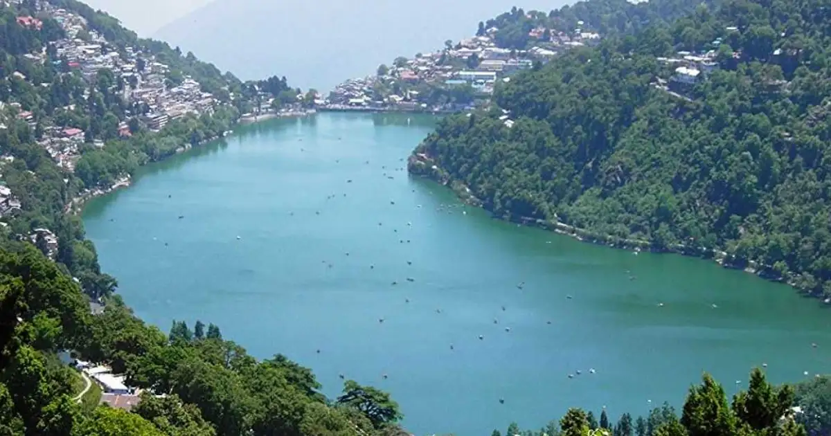
The district is known for its lakes: Naini, Bhimtal, Sattal and Naukuchiatal are counted among the four important lakes of Kumaon. Hill roads are slow, so plan journeys by road corridor rather than by distance on a map.
History of Nainital District
Nainital’s name comes from Naina (eye) and tal (lake). A local tradition says that the eye of Sati fell here, and the Naina Devi Temple on the north shore of the lake is dedicated to the goddess. The Skanda Purana is said to refer to the place as Tri-Rishi-Sarovar. Historically, the area was part of the Kumaon region.
The British took Kumaon and Garhwal in 1815 after the Anglo-Nepalese War of 1814-16. According to the district administration, the town’s modern story began in 1841, when P. Barron, a sugar trader from Shahjahanpur, saw the lake and built the first European house, called Pilgrim Lodge. In the same year, a Calcutta newspaper announced the “discovery” of the lake. Nainital grew into a hill station with churches, schools and cottages.
A major landslide in 1880 destroyed the Naina Devi Temple, which was later rebuilt, and a road link from Kathgodam to Nainital was built in 1882. Haldwani served as the winter headquarters of the officers of Kumaon division and Nainital district.
After Independence, the district became part of Uttar Pradesh, and in 2000 it became part of the new state of Uttarakhand. The district website gives a short historical background of the town if you want the official version.
Famous Places to Visit in Nainital District
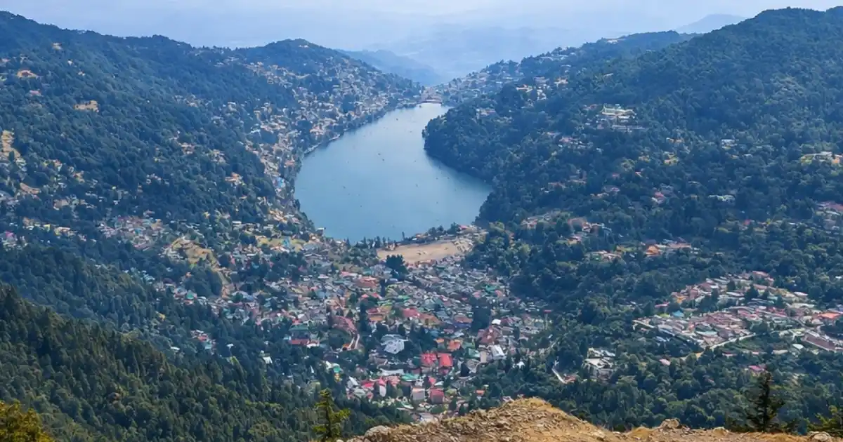
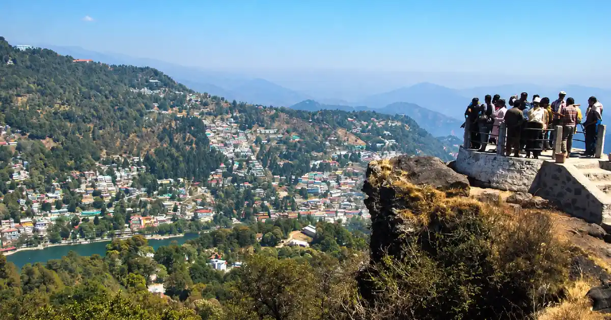

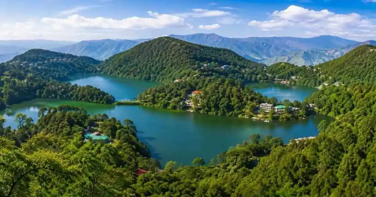
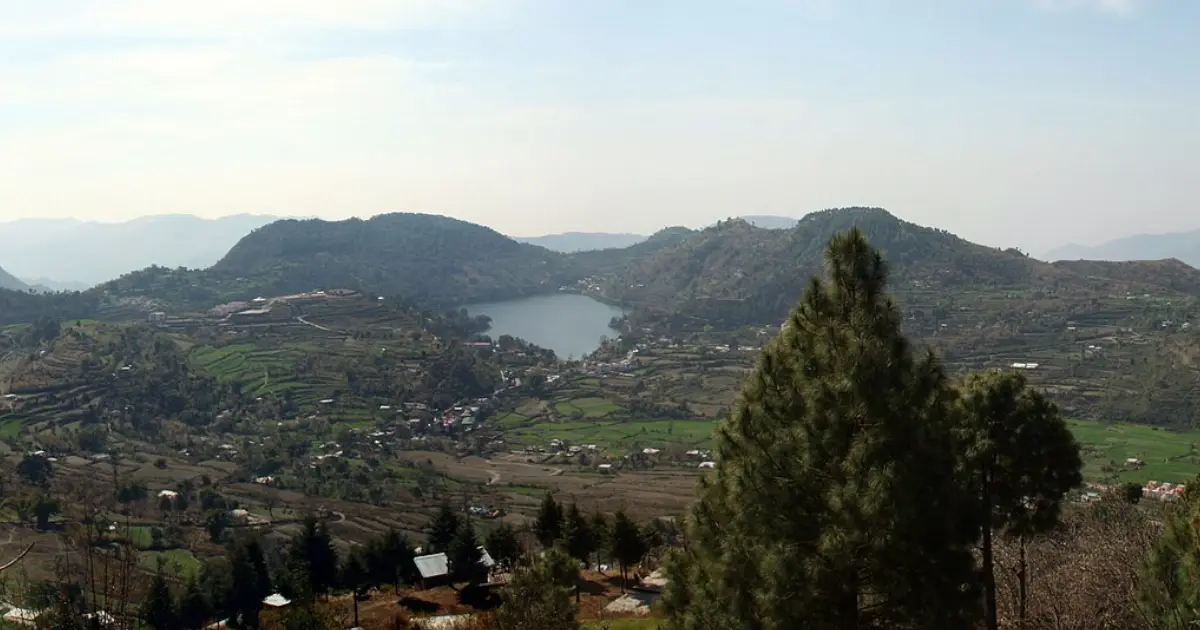
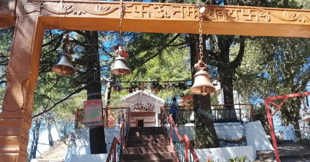
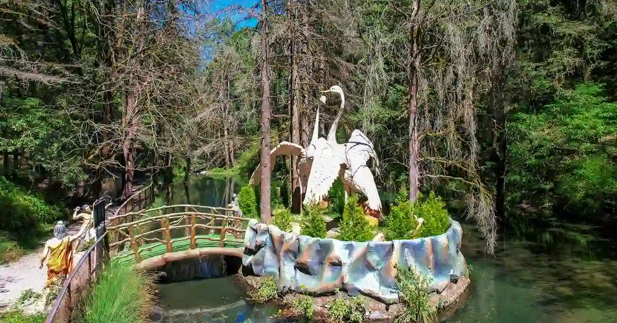
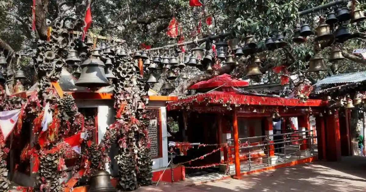
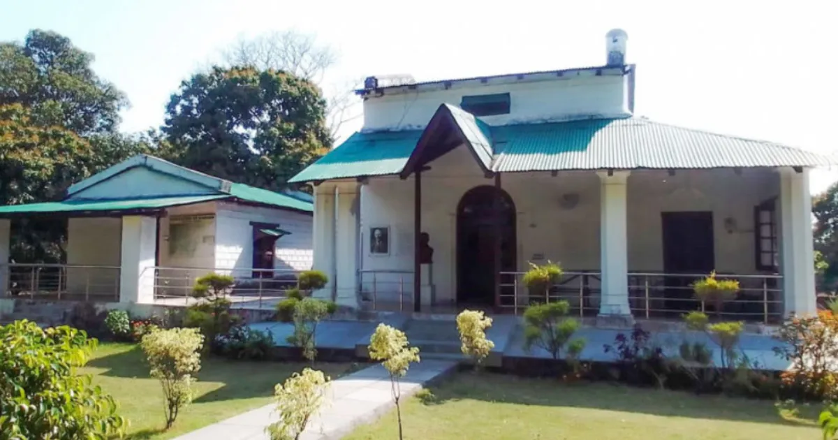
Distances in this guide are approximate. Opening days, entry rules and seasonal access can change, so check the current arrangements for each place before you travel.
Religious and Heritage Sites
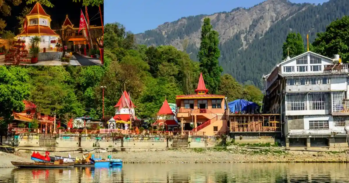
- Naina Devi Temple, Nainital: A Shakti shrine on the north shore of Naini Lake, tied to the legend of Sati’s eye.
- Kainchi Dham: An ashram founded by Neem Karoli Baba, with a Hanuman idol installed on 15 June 1964, which is why the foundation-day fair is held on that date every year.
- Mukteshwar Dham: A Shiva temple at the highest point of the Mukteshwar village, on the veterinary institute campus, with the Chauli Ki Jali cliffs close behind it.
- Ghorakhal Temple: A shrine of Golu Devta, a deity worshipped across Kumaon.
- St. John in the Wilderness, Nainital: A colonial-era church whose foundation stone was laid in 1844, one of the oldest buildings in the town.
- Jim Corbett Museum, Kaladhungi: Corbett’s bungalow, built in 1922, which now displays his belongings, letters, and photographs.
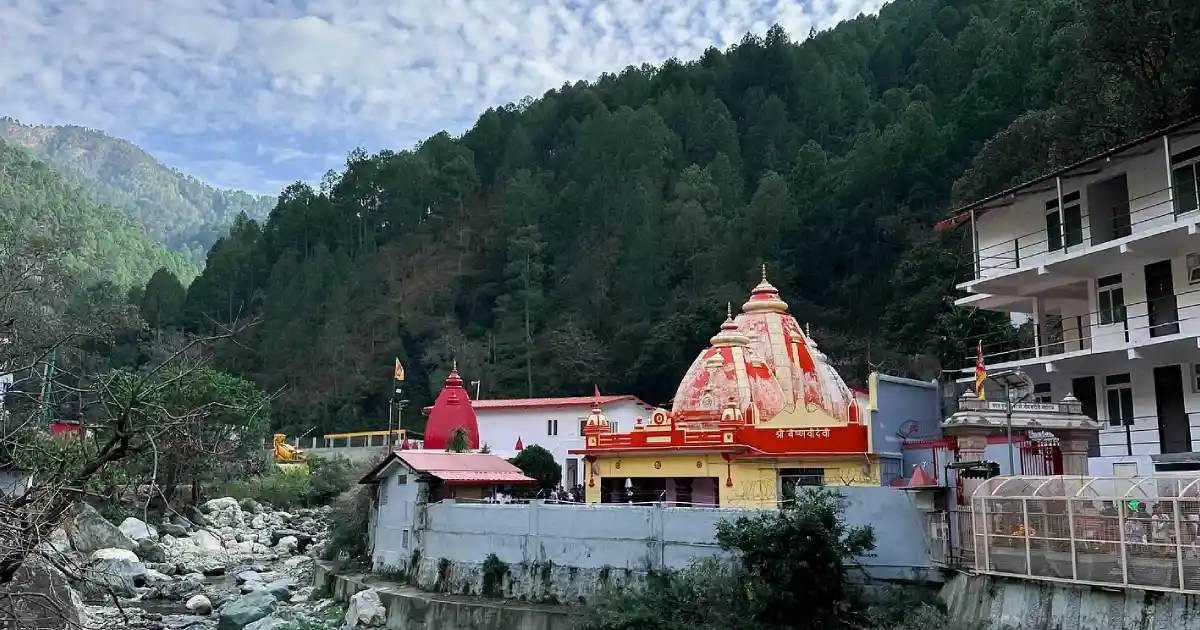
Many of these are active places of worship. Dress modestly, follow temple rules, and expect very large crowds at Kainchi Dham around 15 June, when traffic on the Bhowali-Kainchi Dham road is usually diverted.
Kainchi Dham, Mukteshwar and the Corbett Foothills
Kainchi Dham lies on the Nainital-Almora road, about 9 km from Bhowali and 17 km from Nainital according to the district website, at an altitude of around 1,400 metres. The ashram’s yearly fair on 15 June is also listed on the Ministry of Culture’s Utsav portal. If you are travelling during the fair, plan for long queues, road diversions and slower traffic. Early mornings on ordinary days are calmer.
Mukteshwar is a hill village at about 2,286 metres, about 51 km from Nainital and 40 km from Bhowali, according to the district website. The Indian Veterinary Research Institute was established here in 1893, and its Mukteswar campus is still part of the institute (see the IVRI campus page). On clear days, the Nanda Devi, Nanda Kot, Trishul and Panchachuli peaks can be seen. Chauli Ki Jali, a rock formation about 250 metres behind the temple, is used for rock climbing and rappelling.
Kaladhungi and Ramnagar lie in the foothills. Jim Corbett lived at Choti Haldwani near Kaladhungi, and his house is now a museum. Ramnagar is the main gateway town for the Corbett landscape; Corbett was set up in 1936 as India’s first national park, then named Hailey National Park, and was renamed after Jim Corbett in 1957.
Safari zones, permits, and booking rules for the reserve are managed by the Uttarakhand forest authorities, so check current arrangements before planning.
How to Reach Nainital
By air: The nearest airport with scheduled commercial flights is Pantnagar Airport (PGH) in Udham Singh Nagar district. It is about 26 km from Haldwani and, by a rough estimate via Haldwani, about 65-70 km from Nainital town. Booking portals list domestic flights to cities such as Delhi, but airlines and schedules change, so check before you plan. A taxi or the Haldwani bus is needed for the rest of the journey.
By rail: Kathgodam, about 34-35 km from Nainital, is the nearest railhead, and it is linked by broad gauge to Delhi, Dehradun, Lucknow and Howrah. Trains such as the Ranikhet Express, Sampark Kranti Express, Shatabdi Express and Bagh Express run from Kathgodam, according to the ARIES Nainital travel page. Lalkuan, about 60 km from Nainital, is another railhead, and Haldwani and Ramnagar also have stations. Taxis and shared cabs run from Kathgodam and Haldwani to Nainital.
By road: According to the district website, daily roadway buses run to Nainital from Delhi, Agra, Dehradun, Haridwar, Lucknow, Kanpur and Bareilly, and luxury coaches are available from Delhi. The usual road route from Delhi runs via Moradabad, Haldwani and Kathgodam.
Distances from Nainital (district website, rounded): Kathgodam 34 km, Haldwani 40 km, Lalkuan 60 km, Ramnagar 65 km, Ranikhet 62 km, Almora 64 km, Kausani 117 km, Champawat 160 km, Pithoragarh 186 km, Bareilly 140 km, Delhi 310 km, Dehradun 300 km, Haridwar 245 km, Lucknow 400 km, Agra 403 km and Badrinath 334 km. Some travel sites quote slightly different figures for the same routes, such as about 277-300 km for Delhi, and about 260 km for Rishikesh, so treat distances as approximate.
Kainchi Dham is about 17 km, Bhimtal about 22 km, Sattal about 23 km, Naukuchiatal about 26 km, and Mukteshwar about 51 km from Nainital. Landslides can delay journeys during the monsoon, so confirm current bus or taxi services before departure. You can also read our guide to flash floods in Uttarakhand for monsoon safety.
Weather and Best Time to Visit
The weather in Nainital district depends heavily on altitude. Nainital town, Mukteshwar and Kilbury are cool or cold in winter, while Haldwani, Kaladhungi, Lalkuan and Ramnagar at the foot of the hills are warmer and can be hot in summer.
Live weather and temperature for Nainital. Haldwani and the foothills are warmer, and higher ridges are colder. For the official forecast, see the India Meteorological Department.
As a rough guide, Nainital town sees daytime highs of about 14°C in January with night lows near 4°C, and highs near 28°C in June, according to published climate summaries. Snowfall, when it happens, is mostly in December to February and is most likely in January. Check a live forecast for the weather report on your exact dates.
- Winter (December to February): Cold, with occasional snowfall at higher points. Mornings and nights are cold, so carry woollens. Roads on higher ridges can be affected.
- Spring and early summer (March to June): Pleasant and the busiest season, good for sightseeing and the lakes.
- Monsoon (July to September): Heavy rain, green hills and fewer crowds, but landslide risk on hill roads. Check current conditions before travelling.
- Autumn (October to November): Clear skies and cool days with good mountain views; many travellers regard October as one of the best months.
March to June and September to November are generally the best months to visit Nainital. For snow, plan for late December to January, and keep the plan flexible.
Nainital District Map and Location
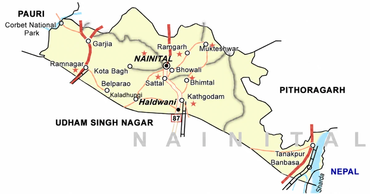
On the Nainital district map, the district lies in the central-southern part of Kumaon, with Nainital town in the north-central part and Haldwani in the south. It is bordered by:
- North: Almora district.
- South: Udham Singh Nagar district.
- East: Champawat district.
- West: Pauri Garhwal district (the Corbett landscape).
- South-west: The plains of Uttar Pradesh.
Neighbouring districts touch Nainital at different points, so the compass directions above are approximate. Use an official map or a navigation app for road distances and current route conditions. For the Kumaon neighbours, see our guides to Udham Singh Nagar and Pauri Garhwal.
Accommodation and Where to Stay
Choose your overnight base around the main purpose of the trip:
- Nainital town: Hotels and guesthouses around Mallital, Tallital and the Mall Road, convenient for the lake and viewpoints. Rooms fill up quickly on weekends and in the May-June season.
- Bhimtal, Sattal and Naukuchiatal: Lakeside hotels, resorts and homestays, quieter than Nainital town.
- Ramgarh and Mukteshwar: Orchard stays, cottages and heritage bungalows, with mountain views and cooler nights.
- Kainchi Dham and Bhowali: Simple hotels and homestays for visiting the ashram and breaking the Nainital-Almora journey.
- Ramnagar and Kaladhungi: Resorts and lodges for the Corbett landscape and the Corbett Museum.
- Haldwani and Kathgodam: City hotels near the railway station and bus stand, useful for late arrivals and early departures.
Confirm heating, meals, hot water, parking, road access, and cancellation terms directly. In peak season, and around the Kainchi Dham fair on 15 June, book well ahead and check traffic arrangements.
Suggested Itineraries
These are planning examples, not fixed packages or confirmed operating routes.
- Two days in Nainital town: Naini Lake, Naina Devi Temple, the Mall Road, Tiffin Top and Naina Peak.
- One-day lake circuit: Bhimtal, Naukuchiatal and Sattal, which sit close together; Naukuchiatal is about 4 km from Bhimtal.
- Kainchi Dham and Mukteshwar: A two-day trip along the Nainital-Almora road, stopping at Bhowali and Kainchi Dham and continuing to Mukteshwar for Chauli Ki Jali and the Himalayan views.
- Corbett foothills: Nainital to Kaladhungi for the Jim Corbett Museum, then on to Ramnagar for the Corbett landscape.
- Nainital to Almora and Ranikhet: A road trip into Almora district; Ranikhet is about 62 km and Almora about 64 km from Nainital.
- Nainital to Pithoragarh: A long drive of about 186 km for the eastern Kumaon circuit; see our Pithoragarh district guide.
Adjust the plan to your starting city, transport, and season. Hill roads are slow, so allow extra time between places.
Sports in Nainital District
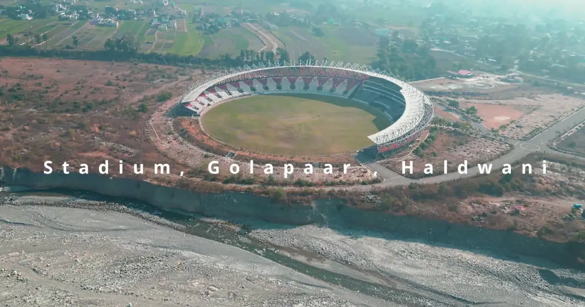
Nainital district’s sports life is spread between the hill campuses and the city of Haldwani. Haldwani is the district’s main sports hub: the Indira Gandhi International Sports Stadium at Gaulapar, on the Haldwani bypass road, is a multi-sports complex with a capacity of about 25,000. Its foundation stone was laid on 9 November 2014, and its international cricket ground was inaugurated on 18 December 2016, according to published reports. It is the home ground of the Uttarakhand football team, and the District Sports Office is based at the Sports Stadium in Haldwani.
The stadium is also where the Uttarakhand State Sports University is coming up. Reports say that on National Sports Day 2026, the Chief Minister laid the foundation stone for Phase 1 construction of the university and the Mansi Khand Sports Complex at the International Stadium, Gaulapar, at an estimated cost of Rs 43.50 crore, and opened the first academic session. For state-level context, see our guides on the Uttarakhand Sports University in Haldwani, popular sports in Uttarakhand and the Uttarakhand Sports Department.
Students and parents should enquire through their school, college or the District Sports Office about coaching and the path to recognised competitions. Coaching availability differs by sport and location, so confirm the current programme before travelling to a facility or enrolling a child. Colleges such as Kumaun University at Nainital and the M.B.P.G. College at Haldwani also send teams to inter-university tournaments.
Adventure, Water Sports and Outdoor Activities
The lakes and hills make Nainital district a base for outdoor activities rather than a single sport. Boating is the signature activity on Naini Lake, where the old Nainital Yacht Club still offers boats for hire, and Naukuchiatal is known for boating and paragliding. Mukteshwar’s Chauli Ki Jali cliffs are used for rock climbing and rappelling, and trekking routes lead up to Naina Peak and around Sattal. Bird watching is popular around Sattal, Kilbury and Pangot.
Adventure operators, equipment standards and safety rules vary. Use registered operators, check the weather and water conditions, and ask whether instructors are qualified before you book. For the state’s wider adventure and winter-sports plans, read about the new academies and women’s college.
Sports Facilities, Training and Athlete Opportunities
The Sports Department of the Government of Uttarakhand runs district-level programmes through the District Sports Office in Haldwani. The department’s directory lists the office at the Sports Stadium, Haldwani, with telephone number 05946-220883; numbers can change, so verify them on the Department of Sports website before calling. Ask about coaching, trials, age groups, and the documents required.
Keep age, residence, and achievement records ready, because availability and eligibility differ between programmes. Young athletes can start with school and college sports, and with the trials organised by the Sports Department.
Sportspersons from Nainital District
Manish Pandey was born in Nainital on 10 September 1989, though he moved to Bengaluru at the age of 15 and plays domestic cricket for Karnataka. He was part of India’s 2008 Under-19 World Cup-winning squad, was named in India’s squad that won the 2018 Asia Cup, and won the IPL with Kolkata Knight Riders in 2014 and 2024.
Kamal Singh, born in Haldwani on 29 November 2000, is a cricketer who made his first-class debut for Uttarakhand on 12 February 2020 in the Ranji Trophy, scoring a century in the first innings.
Vaibhav Bhatt, born in Haldwani on 25 November 1995, is a wicketkeeper who has played List A, first-class and T20 cricket for Uttarakhand.
This list is not exhaustive. For more athletes from across the state, see our list of famous Uttarakhand sportspersons.
Education, Training and Research Institutions
Nainital district is a major education centre in Kumaon. Institutions and facilities include:
- Kumaun University, Nainital: A state university with its main campus at Nainital.
- ARIES, Nainital: The Aryabhatta Research Institute of Observational Sciences, a national research institute for astronomy and atmospheric sciences, located near the town (see the ARIES travel page).
- IVRI, Mukteswar campus: The hill campus of the Indian Veterinary Research Institute, which dates from 1893.
- Sainik School, Ghorakhal: A well-known residential school near Bhowali.
- M.B.P.G. College, Haldwani: A major degree college in Haldwani.
- Government degree colleges and inter colleges: Present in the main towns of the district; check each institution for courses and admissions.
Students preparing for state government jobs can read our guides to the UKPSC and the UKSSSC. Students should check current courses, admissions, fees, and eligibility directly with each institution.
Administrative Structure
The District Magistrate heads the district administration, assisted by the Chief Development Officer and the Project Director of the District Rural Development Agency. The district website and recent transfer reports from October 2025 name Lalit Mohan Rayal (IAS) as District Magistrate, but officers change with postings, so check the district website for the current DM and contact details. The DM office telephone listed on the website is 05942-235684.
The district has 8 development blocks: Betalghat, Bhimtal, Dhari, Haldwani, Kotabagh, Okhalkanda, Ramgarh and Ramnagar. Revenue administration works through tehsils: the district had eight tehsils (Nainital, Haldwani, Ramnagar, Kaladhungi, Lalkuan, Dhari, Betalghat and Kosya Kutauli) in the 2011 Census and the 2013 audit, and newer lists add more units such as Kainchi Dham, Khansyun, Okhalkanda and Ramgarh.
Check current district notices, as administrative units have been added over time. Urban local bodies include Haldwani, Nainital, Ramnagar, Bhowali, Bhimtal, Kaladhungi and Lalkuan. The district has six assembly constituencies.
For a certificate or local service, first identify the relevant village, block, tehsil, or municipal office. For the state’s leadership, see our page on the Chief Minister of Uttarakhand.
Important Towns and Settlements
- Nainital: District headquarters and divisional headquarters of Kumaon; population 41,377 in the 2011 Census.
- Haldwani-cum-Kathgodam: The largest city of the district and of Kumaon; 2,01,461 in the 2011 Census, including its outgrowth.
- Ramnagar: A town on the foothills route and a gateway to Corbett; 54,787 in the 2011 Census.
- Bhowali: A road junction about 11 km from Nainital at roughly 1,706 metres, where routes to Almora and Bhimtal divide.
- Bhimtal: A lake town and a place where several district offices are located.
- Kaladhungi: A foothill town known as Jim Corbett’s home.
- Lalkuan: A railway junction town on the southern edge of the district, about 60 km from Nainital.
- Mukteshwar and Ramgarh: Hill villages known for views and orchards.
These places lie along different travel corridors. Select accommodation and transport according to the destination you intend to explore.
Nature and Biodiversity
Nainital district’s forests range from the sal and mixed forests of the foothills near Kaladhungi and Ramnagar to oak, pine and deodar at higher altitudes. The foothills lie close to the Corbett landscape, and Sitabani near Ramnagar is part of it. Higher up, Pangot and Kilbury are known for bird watching, and Sattal and Naukuchiatal attract water birds and butterflies. Mukteshwar is surrounded by fruit orchards and coniferous forest.
Wildlife sightings are never guaranteed. Follow forest rules, take your waste back, and keep away from animals. Lake health is also a concern: the water quality of Naini Lake is affected by drainage, and the surrounding slopes are landslide-prone, so avoid littering and follow local guidance.
Culture, Traditions, Festivals and Fairs
Nainital district’s culture is mainly Kumaoni, with a strong colonial-era heritage in the hill stations and a more mixed population in the foothill towns. Kumaoni is the first language of about half the people, followed by Hindi, and the district also has Urdu-speaking (about 6.6 per cent) and Punjabi-speaking (about 2.1 per cent) communities, according to the 2011 Census.
Notable events include the Kainchi Dham fair on 15 June, which draws huge crowds, and temple festivals at Naina Devi and other shrines. You can also read about the Kumaoni festival Harela.
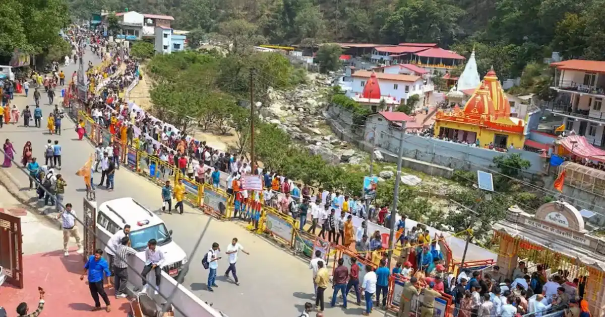
Dates and programmes differ from year to year. Village celebrations also vary across the district, so ask local hosts about the customs of the place you are visiting rather than assuming every community follows the same practice.
Local Food
Food in Nainital district reflects Kumaoni mountain cuisine and the tastes of a tourist and market town. Depending on the household and season, meals may feature mandua, jhangora, bhatt (black soybean), gahat (horse gram) and other pulses, leafy vegetables and simple home-style preparations.
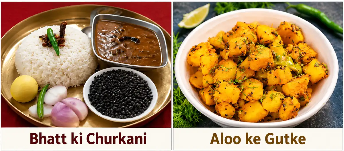
Dishes to ask about include bhatt ki churkani, aloo ke gutke and kafuli. These belong to Kumaon’s broader cuisine and are not specific to Nainital, and they may not appear on every restaurant menu. The Mukteshwar and Ramgarh belts are known for orchards, and hill-town eateries mostly serve North Indian and tourist-friendly food. Nainital’s Mall Road and Haldwani have the widest choice of restaurants.
Homestays can be a good place to learn about household food traditions. Confirm meals in advance, especially if you have dietary requirements or will arrive late.
Livelihoods and the Local Economy
Tourism is the main economic activity in the hill areas: hotels, homestays, boating, taxi services, guides, and the market around the lakes depend on seasonal visitors. Horticulture matters around Ramgarh and Mukteshwar, where orchards are an important source of income, and agriculture continues in the valleys and the foothills. Haldwani is the district’s main commercial and trading centre.
Research and education institutions such as Kumaun University, ARIES and IVRI also employ many people. Many families have members in the armed forces and government service.
Visitors can support the local economy through locally operated stays, produce and skilled services. Young people considering work in tourism, adventure or sports should enquire about training, qualifications and the operating requirements for the activity they want to pursue.
Healthcare, District Administration and Emergency Contacts
Emergency assistance: 112 | Ambulance: 108 | Disaster helpline: 1077.
Nainital town and Haldwani have the main hospital facilities of the district, and smaller hospitals and health centres serve other towns. Facilities in remote hill areas are farther apart, so plan travel and medical needs, especially for treks, winter travel, and the monsoon. For hospital details, contact the Chief Medical Officer’s office through the district website.
For district office and department numbers, use the directory on the District Administration website. For disaster-related notices, see the district disaster management page.
Contacts and facilities were reviewed on 26 October 2026; telephone availability has not been tested. Use 112 for immediate emergencies, and take extra care on steep hill roads, near lakes and rivers, and during the monsoon.
Frequently Asked Questions
Nainital Uttarakhand: where is it?
Nainital is a town and district in the Kumaon division of Uttarakhand, in northern India. The town is the district headquarters and is built around Naini Lake.
Which state is Nainital in?
Nainital is in Uttarakhand, in northern India.
What is the location of Nainital district?
It lies in the Kumaon foothills of the outer Himalayas, with Almora district to the north and Udham Singh Nagar district to the south.
What is the Nainital district map?
Nainital district lies in central-southern Kumaon, with Nainital town in the north-central part and Haldwani in the south. See the map section above.
What is the headquarters of Nainital district?
The district headquarters is Nainital town, which is also the divisional headquarters of Kumaon.
What are the tehsils of Nainital district?
The district had eight tehsils in the 2011 Census: Nainital, Haldwani, Ramnagar, Kaladhungi, Lalkuan, Dhari, Betalghat, and Kosya Kutauli. Newer lists include more units, so check the district website for the current list.
What are the blocks of Nainital district?
There are eight development blocks: Betalghat, Bhimtal, Dhari, Haldwani, Kotabagh, Okhalkanda, Ramgarh, and Ramnagar.
What is the population of Nainital district?
The Census 2011 district total is 9,54,605. It should not be presented as a current estimate.
What is the history of Nainital district?
Nainital was part of Kumaon and came under British rule in 1815. The hill station was founded in 1841 by P. Barron, and the district became part of Uttarakhand in 2000.
What is Nainital district famous for?
It is known for Naini Lake, the lakes of Bhimtal, Sattal and Naukuchiatal, Kainchi Dham, Mukteshwar, Haldwani and the Corbett foothills.
What is the Nainital PIN code?
The PIN codes of Nainital town are 263001 and 263002. Other places have their own codes; for example, Haldwani is 263139, and Bhimtal is 263136. Check the India Post search for the exact town or village.
Who is the DM of Nainital?
The District Magistrate heads the district administration. The district website and reports from October 2025 name Lalit Mohan Rayal (IAS), but officers change with postings, so check the district website for the current DM.
What is the weather in Nainital?
Nainital town is cool through most of the year, cold in winter and mild in summer, while Haldwani and the foothills are warmer. Check the live forecast for your dates.
What is the temperature in Nainital?
Typical daytime highs are about 14°C in January and about 28°C in June, with winter night lows near 4°C. Higher places are colder.
What is the weather in Nainital, Uttarakhand, today?
Weather changes daily with altitude and season. Use the live weather widget in this guide or the India Meteorological Department for today’s forecast.
What is the best time to visit Nainital?
March to June and September to November are generally the best. For snow, December and January are likelier, and the monsoon can disrupt roads.
Is Haldwani in Nainital district?
Yes. Haldwani is the largest city of the district and of Kumaon.
Is Bhimtal in Nainital district?
Yes. Bhimtal is a lake town and a development block in Nainital district, about 22 km from Nainital.
Is Ramnagar in Nainital district?
Yes. Ramnagar is a tehsil and development block of Nainital district, and a gateway to the Corbett landscape.
Is Kainchi Dham in Nainital district?
Yes. Kainchi Dham is in Nainital district, on the Nainital-Almora road about 17 km from Nainital.
Is Mukteshwar in Nainital district?
Yes. Mukteshwar is a hill village in Nainital district, about 51 km from Nainital according to the district website.
What is Nainital Lake?
Naini Lake is a natural freshwater lake in the centre of Nainital town. It is one of the four important lakes of Kumaon, along with Sattal, Bhimtal and Naukuchiatal.
What are the tourist places in Nainital?
Popular places include Naini Lake, Naina Devi Temple, Naina Peak, Tiffin Top, Bhimtal, Sattal, Naukuchiatal, Kainchi Dham, Mukteshwar, Kilbury and the Jim Corbett Museum.
What places can you visit in Nainital?
See the places-to-visit section above for the main sights, with approximate distances from the town.
What is Ramgarh in Nainital, Uttarakhand?
Ramgarh is a hill area and development block of Nainital district, known for its orchards and mountain views. It is roughly 30-35 km from Nainital by road.
How to reach Nainital?
The nearest railhead is Kathgodam (about 34-35 km) and the nearest airport with scheduled flights is Pantnagar. The rest of the journey is by road, and buses run from Delhi, Dehradun, Haridwar, and Lucknow.
What is the distance from Nainital to major cities?
According to the district website, Nainital is about 310 km from Delhi, 300 km from Dehradun, 245 km from Haridwar, 400 km from Lucknow, 40 km from Haldwani, and 34 km from Kathgodam.
What is the Delhi to Nainital distance?
About 310 km by road, according to the district website. Other sources quote roughly 277-300 km depending on the route, and the drive takes around 6-7 hours.
What is the Kathgodam to Nainital distance?
About 34-35 km, around an hour or a little more by taxi.
What is the Haldwani to Nainital distance?
About 40 km by road.
What is the Dehradun to Nainital distance?
About 300 km by road according to the district website; some sources quote up to 350 km depending on the route.
What is the Lucknow to Nainital distance?
About 400 km by road.
What is the Haridwar to Nainital distance?
About 245 km by road according to the district website.
What is the Rishikesh to Nainital distance?
Roughly 260 km by road according to a travel-site estimate. The district website does not list Rishikesh, so check a navigation app for the current route.
What is the Nainital to Kainchi Dham distance?
About 17 km on the Nainital-Almora road, roughly 45 minutes to an hour by road.
What sports are popular in Nainital district?
Cricket, football, basketball, badminton and athletics are played in schools, colleges and stadiums, and the lakes and hills support boating, paragliding, rock climbing and trekking.
Which sportspersons are from Nainital?
Cricketer Manish Pandey was born in Nainital, and cricketers Kamal Singh and Vaibhav Bhatt were born in Haldwani.
Useful Official Links
District Administration | Places of Interest (District Website) | District Disaster Management | Uttarakhand Tourism | Kumaon Mandal Vikas Nigam | Census 2011 District Handbook (PDF) | Nainital District (Wikipedia) | Department of Sports | Disaster Management
Population, language and religion: Census 2011 (Census of India district handbook and census tables). Area, tehsils and blocks: Nainital district administration, the CAG audit report on Nainital district (2013) and Wikipedia lists. Places and distances: Nainital district administration, ARIES, and published travel sources. Sportspersons: Wikipedia and ESPNcricinfo-based profiles. Elevations and distances: published sources and may vary. Information reviewed: 26 October 2026.
One Response