
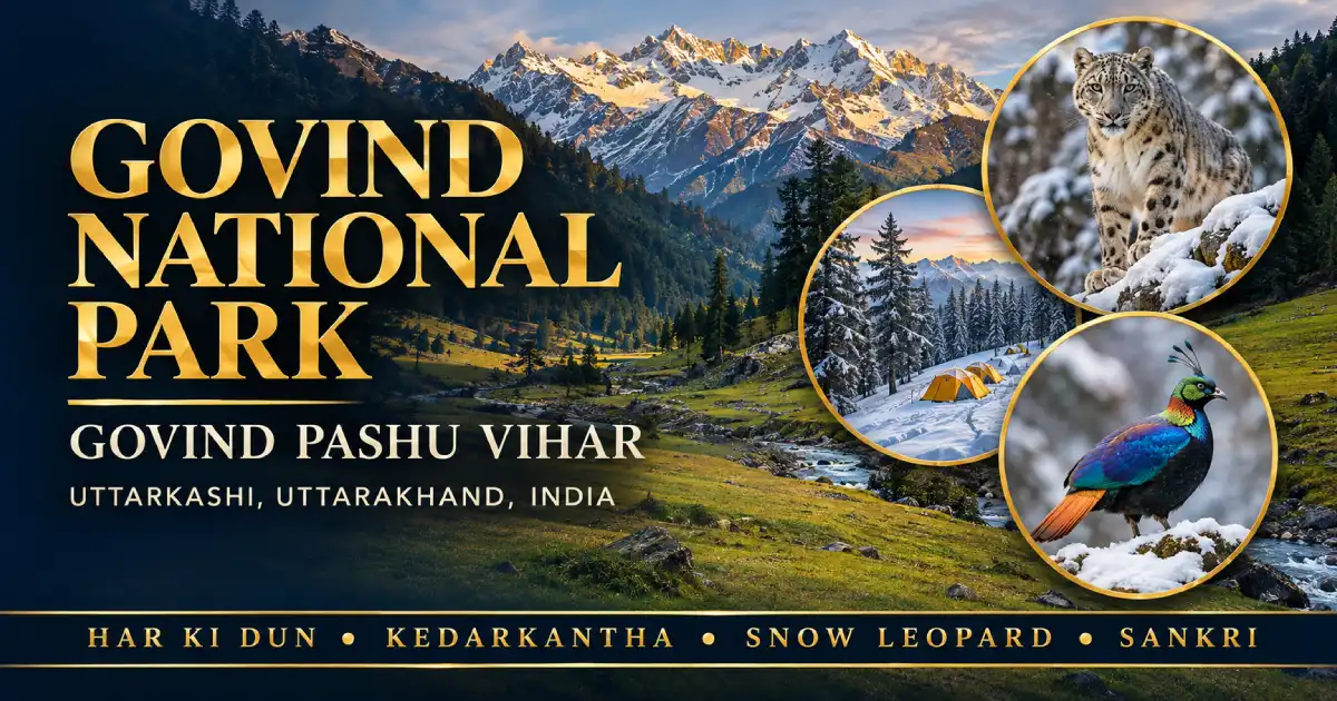
Govind National Park, officially Govind Pashu Vihar National Park, lies in the Supin range of Uttarkashi district in Uttarakhand, in the upper valley of the Tons River. The sanctuary was established in 1955, and the national park followed in 1990. Together, they cover about 958 sq km, and the national park itself is about 472 sq km. It is named after the freedom fighter Govind Ballabh Pant, and it is known as snow leopard country. Most visitors come to walk, because Har Ki Dun, Kedarkantha, and Ruinsara Tal all start from the base village of Sankri. This guide covers its history, wildlife, treks, permits, best time to visit, and a new plant species found here this year.
What Is Govind National Park?
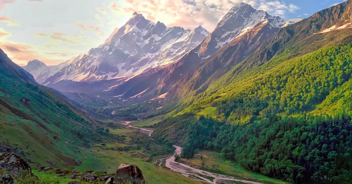
There are two names and one place, and that confuses a lot of people. Govind Pashu Vihar was notified as a wildlife sanctuary in 1955, when Uttarakhand was still part of Uttar Pradesh. Later, a smaller core of the area was upgraded to a national park, which is the Govind National Park most people search for. Both sit side by side in the Rupin and Supin valleys, and visitors move through them without noticing the line.
There are no jeep safaris here. The park is mountain country, and you see it on foot. It is one of the six parks in our guide to the national parks in Uttarakhand.
- Location: Uttarkashi district, Garhwal Himalaya, Uttarakhand
- Sanctuary notified: 1955
- National park: around 1990 (the Wildlife Institute of India’s page gives 1991, so sources differ)
- Area: about 958 sq km for the sanctuary and park together, about 472 sq km for the national park
- Named after: Govind Ballabh Pant, the freedom fighter
- Altitude: roughly 1,300 m to over 6,300 m
- Famous for: snow leopard habitat, Har Ki Dun, Kedarkantha
- Base village: Sankri
- Entry: on foot, with a forest permit
Where Is Govind National Park?
The park lies in Uttarkashi district, in the Supin range, and it covers the whole catchment of two rivers, the Rupin and the Supin. They meet at Naitwar to form the Tons, which is the main tributary of the Yamuna. A forest check post at Naitwar is where you formally enter the sanctuary. From there, the road climbs to Sankri, the last proper village and the starting point of almost every trek.
To place it on a map, it sits in the northwest corner of Garhwal, close to the Himachal border, roughly 200 km from Dehradun by road. You can find the district on our Uttarakhand district map. To the east lies Gangotri National Park, and the Wildlife Institute of India describes the two, together with the Kedarnath Wildlife Sanctuary, as one continuous conservation landscape.
History: Why It Is Called Govind Pashu Vihar
“Pashu Vihar” simply means a wildlife sanctuary, and the name Govind honours Govind Ballabh Pant. The Uttar Pradesh government notified the upper Tons valley as a sanctuary in 1955, mainly to protect the forests and wildlife of the Rupin and Supin catchments. The national park status came about thirty-five years later.
The park has also become tied to India’s work on the snow leopard. The Wildlife Institute of India lists the region as an area of importance for snow leopard conservation, and several sources say India’s Snow Leopard Project was launched from here.
Forests and Flora
The vegetation changes with every few hundred metres you climb, which is half the fun of the trek. The Wildlife Institute of India describes it in zones.
- Sub-tropical, about 1,200 to 1,700 m: chir pine and alder
- Temperate, about 1,700 to 3,500 m: oak, deodar, walnut, spruce and rhododendron
- Sub-alpine: Himalayan yew, blue pine and a high-altitude rhododendron
- Alpine, above about 3,500 m: meadow grasses and medicinal herbs such as jatamansi and kutki
Walnut trees along the Har Ki Dun trail are easy to spot in autumn. The same page records around 70 species of butterflies in the area, so summer treks are good for them too.
Wildlife in Govind National Park
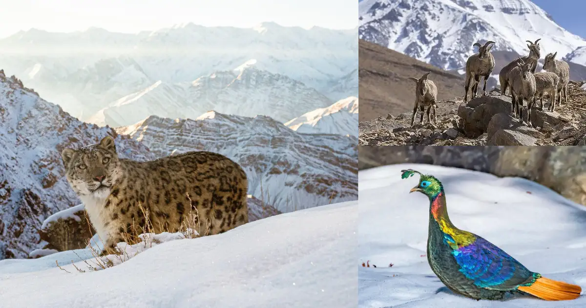
Surveys over the years report roughly 15 to 20 large mammal species and somewhere between 100 and 150 bird species. The numbers differ between studies, so treat them as a range.
- Snow leopard: the animal the park is best known for, though it is very rarely seen
- Bears: Asian black bear and brown bear
- Common leopard: found at lower altitudes
- Musk deer, bharal and Himalayan tahr: the shy and the high-slope grazers
- Serow: a goat-antelope of steep forests
- Birds: Himalayan monal, koklass pheasant, cheer pheasant and western tragopan, with bearded vulture and golden eagle overhead
BirdLife International lists the cheer pheasant and the western tragopan among the globally threatened birds of the area. The Himalayan monal is the state bird of Uttarakhand, and we have a separate guide to the Himalayan monal. Do not plan the trip around seeing a snow leopard. Most trekkers see forest, snow, and peaks, and a monal now and then if they start early.
Har Ki Dun: The Valley of Gods
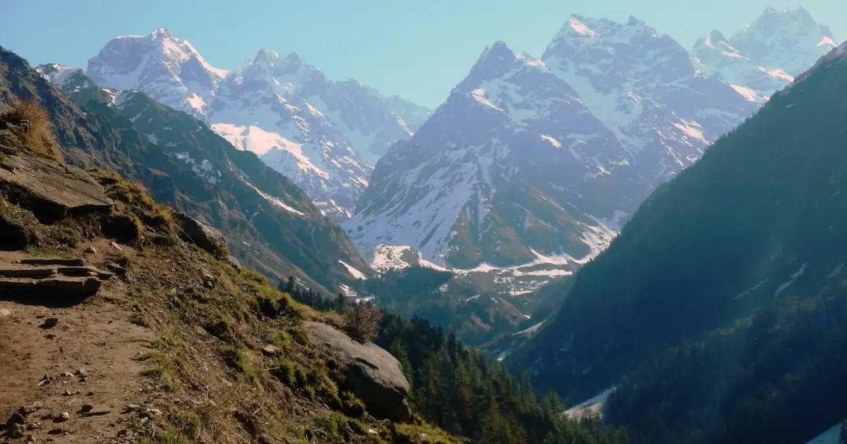
Har Ki Dun means “valley of the gods”, and it is the park’s best-known trek. The valley sits at about 3,566 m (some sources say about 3,500 m), a wide cradle of meadow below Swargarohini and Hata peak. From the valley, you can see the north face of Swargarohini I, which is about 6,252 m high.
The usual route drives from Sankri to Taluka, then follows the Supin River through chestnut, walnut, and pine forest to Seema and Osla before the final climb. Distances vary between sources because the road has been extended up the valley in recent years. One-way, most guides put it at roughly 22 to 25 km from Taluka, and about 35 km or more from Sankri. Most people take 6 to 7 days from Dehradun and back.
Osla, the last village on the way, is known for a temple of Duryodhana, which surprises many first-time visitors.
Treks Inside Govind National Park
- Har Ki Dun: the classic, easy to moderate, about 3,566 m in the valley.
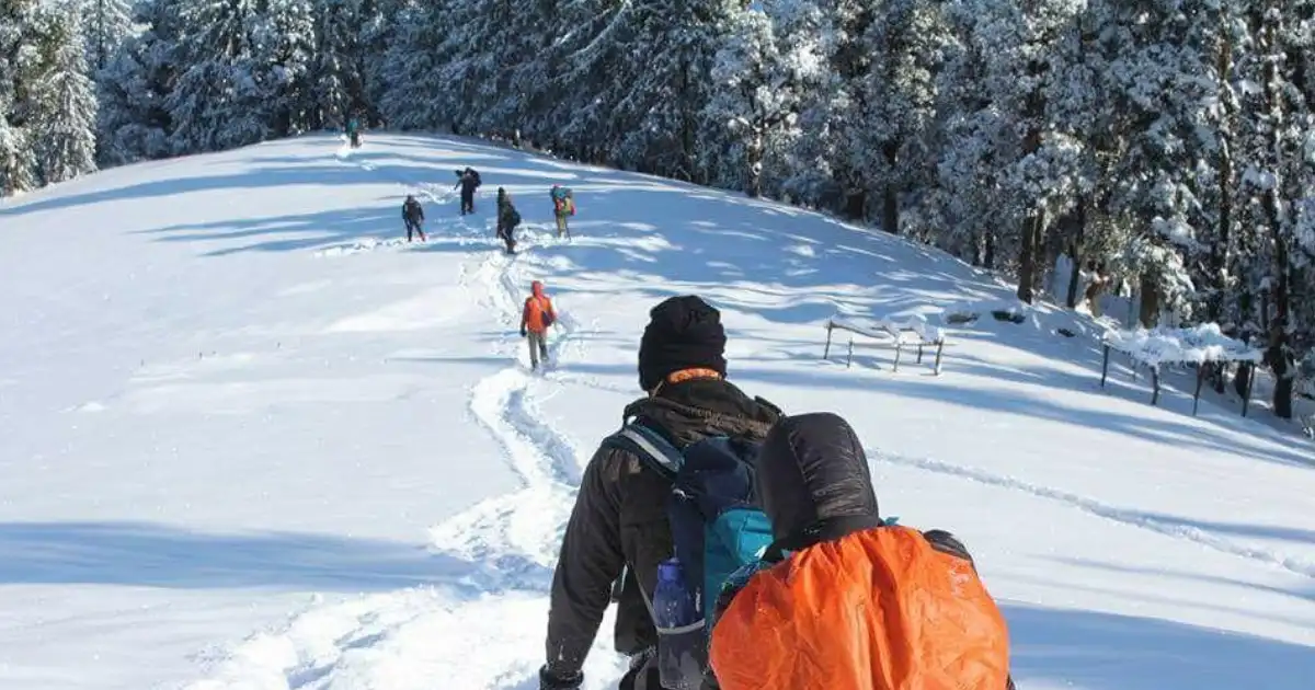
- Kedarkantha: a short winter trek to a summit at about 3,810 m (12,500 ft), usually 4 to 5 days from Sankri, with snow trails and a frozen Juda Ka Talab.
- Ruinsara Tal: a glacial lake at about 3,600 m in the neighbouring valley, often combined with Har Ki Dun. The trails split near Osla.
- Bali Pass and Borasu Pass: harder crossings that also start from Sankri.
- Phulara Ridge: a lesser-known ridge walk with views of Swargarohini, Bandarpunch and Kalanag.
Govind National Park Permit and Rules
You enter through the forest check post at Naitwar, and permits for the treks are handled through the Forest Department, with an office at Purola. Sources differ on whether you should register online first or collect the permit at the check post, so confirm the current process before you travel.
- Fee: one 2026 trek guide quotes about ₹150 for Indian visitors and ₹600 for foreign visitors, valid for 3 days, for the Kedarkantha-side routes. Confirm the current fee when you apply.
- Guide: the same guide says a locally registered guide is required for Kedarkantha. Check the rule for the trek you plan.
- No safari: the park is explored on foot.
- Be ready for patchy network: mobile signal is weak beyond Mori, and Purola is the last place with ATMs.
Season, Dates and the 2026 Update
Two things made news here this year.
- January 2026: trek operators reported that heavy snow and strong winds hit the Sankri and Kedarkantha corridor, and batches on Kedarkantha, Har Ki Dun and Rupin Pass were paused at their campsites instead of being pushed on.
- October 2026: botanists from the Botanical Survey of India described a new plant species, Bupleurum oslaense, found near Osla village at about 2,550 m inside the park. The paper was published online on 21 October 2026. According to a Research Matters report, only one population of three mature plants was found in an area of about 4 sq km, so it has been assessed as Critically Endangered.
Conditions can change quickly in these valleys, so please check with the Forest Department before you plan anything.
Best Time to Visit Govind National Park
It depends on which trek you want. Har Ki Dun is best from April to June and from September to November. Kedarkantha is a winter trek, best from December to March when the trail is under snow. The monsoon is a poor time to go. The Wildlife Institute of India records about 1,500 mm of rain at the lower altitudes in July and August, and winters bring extreme cold and snow for three to four months.
Live Weather in Govind National Park
Check the live weather before you start. This shows the general valley area, and Har Ki Dun and Kedarkantha sit much higher, so expect colder and windier conditions on the trail.
How to Reach Govind National Park
Sankri is about 190 to 210 km from Dehradun, and the drive takes 8 to 10 hours via Mussoorie, Purola, Mori and Naitwar. The nearest airport is Jolly Grant in Dehradun, and Dehradun is also the nearest major railhead. Purola, about 50 km before Sankri, is the last town with ATMs and medical services. Most trekking operators run shared transport from Dehradun, which is the easiest way if you do not have your own vehicle.
Where to Stay and What to Carry
Sankri has guesthouses and homestays, and it is the last place where you can rent or buy trekking gear. Higher up, you camp. Carry warm layers, a rain jacket, sturdy shoes, sunscreen, a first-aid kit, your own medicines, and cash, since cards and ATMs stop working past Purola.
Staying Safe at Altitude
Har Ki Dun is above 3,500 m and Kedarkantha above 3,800 m, so altitude sickness can affect even fit people. Climb slowly, drink water regularly, avoid alcohol, and turn back if a headache or nausea gets worse. If you have a heart or breathing problem, talk to a doctor first.
Frequently Asked Questions
Where is Govind National Park?
In Uttarkashi district of Uttarakhand, in the Supin range of the upper Tons valley, close to the Himachal border.
Why is it called Govind Pashu Vihar?
It is named after the freedom fighter Govind Ballabh Pant, and “Pashu Vihar” means wildlife sanctuary.
When was Govind National Park established?
The sanctuary was notified in 1955, and the national park followed around 1990. The Wildlife Institute of India’s page gives 1991, so sources differ.
Which district is Govind National Park in?
Uttarkashi district, Uttarakhand.
What is Govind National Park famous for?
Snow leopard habitat, the Har Ki Dun valley, and winter treks such as Kedarkantha.
How big is Govind National Park?
The sanctuary and national park together cover about 958 sq km, and the national park alone is about 472 sq km.
Do I need a permit for Govind National Park?
Yes. Entry is through the forest check post at Naitwar, and treks need a Forest Department permit. Confirm the current fee and process before you travel.
What is the best time to visit Govind National Park?
April to June and September to November for Har Ki Dun, and December to March for Kedarkantha.
How far is Sankri from Dehradun?
About 190 to 210 km, roughly 8 to 10 hours by road.
Govind National Park is a place you earn on foot. The reward is the valley at Har Ki Dun, a night under Swargarohini, and a forest still doing its own thing; the price is a slow walk and some planning. Pick the season that suits your trek, carry a permit, and the Tons Valley will do the rest.
Facts in this guide were checked against the Wildlife Institute of India’s page on Govind National Park, BirdLife International, and Research Matters. Permits, fees, trek openings, and weather can change quickly, so please confirm them with the Uttarakhand Forest Department before you travel.