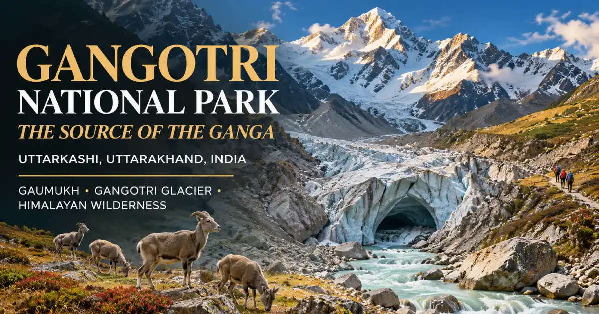
Gangotri National Park sits in Uttarkashi district, in the upper catchment of the Bhagirathi River, and it is the largest protected area in Uttarakhand. It was declared a national park in 1989 and covers about 2,390 sq km, according to the figure most sources use. The land climbs from roughly 1,800 m to over 7,000 m along the India-China border. Inside it lies Gaumukh (also written Gomukh), the snout of the Gangotri Glacier and the source of the Bhagirathi, which later becomes the Ganga. A Forest Department permit is compulsory; only 150 trekkers a day are allowed on the Gaumukh trail, and the park normally opens on 1 April and closes for winter at the end of November. This guide covers its history, height, wildlife, treks, permits, and what has happened on the trails this season.
What Is Gangotri National Park?
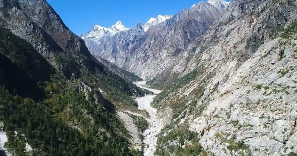
Most people hear “Gangotri” and think of the temple. The national park is the wild half of the same story. It begins a little beyond the shrine, where the road gives up, and from there it is forest, moraine, and ice until you reach the place where the Ganga’s main headstream is born.
The park joins Govind National Park and the Kedarnath Wildlife Sanctuary to make one long belt of protected Himalayan habitat. It is one of the six parks in our guide to the national parks in Uttarakhand, and it is the biggest of them by area.
- Location: Uttarkashi district, Garhwal Himalaya, Uttarakhand
- Established: 1989
- Area: about 2,390 sq km (the Ministry of Tourism’s page lists 1,553 sq km, so sources differ)
- Altitude: roughly 1,800 m to 7,083 m
- Famous for: Gaumukh, Tapovan, Kedartal and the snow leopard
- Season: 1 April to the end of November, with a winter break after that
- Permit: compulsory, with a daily limit of 150 trekkers on the Gaumukh trail
Where Is Gangotri National Park?
It lies in Uttarkashi district, along the upper Bhagirathi valley, and its north-eastern edge runs along the border with China. Gangotri, sometimes spelled Gangothri, is the town at its doorway. Harsil, the nearest town, is roughly 25 to 30 km down the road. Trekkers start from the Kankhu barrier near Gangotri, which is the usual gateway for the Gaumukh route. If you want to place the district on a map, our Uttarakhand district map helps.
Gangotri is also one of the four Char Dham shrines of Uttarakhand, along with Yamunotri, Kedarnath and Badrinath. The temple stands at about 3,000 m on the bank of the Bhagirathi and was built by the Gorkha general Amar Singh Thapa. We have written about it separately in our guide to the Gangotri Dham Mandir.
A Short History of the Park
The country around Gangotri has been a pilgrimage route for centuries, long before anyone thought of it as a protected area. Formal protection came in 1989, when it was declared a national park to safeguard the upper Bhagirathi catchment, its glaciers and the high-altitude wildlife.
Two later decisions shaped how the area is used today. In 2012, the environment ministry declared the Bhagirathi stretch from Gaumukh to Uttarkashi an Eco-Sensitive Zone, covering about 4,179.59 sq km, which restricts certain activities along the river. And Gartang Gali, the wooden walkway on the old India-Tibet trade route, was closed after the 1962 war and reopened to visitors in 2021.
Gaumukh: Where the Bhagirathi Begins
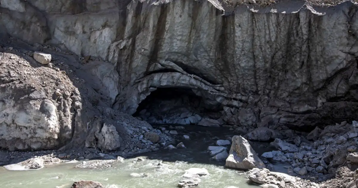
Gaumukh, or Gomukh, means “cow’s mouth”. The name comes from the ice cave at the snout of the Gangotri Glacier, where the Bhagirathi comes out. The glacier is about 30 km long, according to studies by Indian institutes, and it has been shrinking since the 1930s.
One detail trips up a lot of writers. Gaumukh is the source of the Bhagirathi, not of the Ganga under that name. The river becomes the Ganga at Devprayag, where the Bhagirathi meets the Alaknanda.
Gangotri Height: How High Are the Town, Gaumukh and the Park?
“Gangotri height” is one of the most searched things about this area, and the numbers vary a little from source to source. Here they are side by side.
- Gangotri town and temple: about 3,000 m according to the Ministry of Tourism, though other sources go up to about 3,400 m.
- Gaumukh: roughly 3,900 to 4,000 m, depending on the source.
- Tapovan meadows: over 4,400 m.
- Kedartal Lake: about 4,750 m.
- The park as a whole: about 1,800 m to 7,083 m.
Most of the trekking happens above 3,000 m, so altitude sickness is a real thing here. More on that further down.
Forests and Flora
The lower stretch near the park entrance is thick forest: deodar, fir, spruce, chir pine, oak, and rhododendron. As you gain height, the trees thin out. Around Bhojbasa you pass groves of bhojpatra (Himalayan birch), and the settlement is said to take its name from them. Above that, the forest gives way to moraine, scrub, and the alpine meadows of Tapovan, which turn green and flowery for a short window in summer.
Wildlife in Gangotri National Park
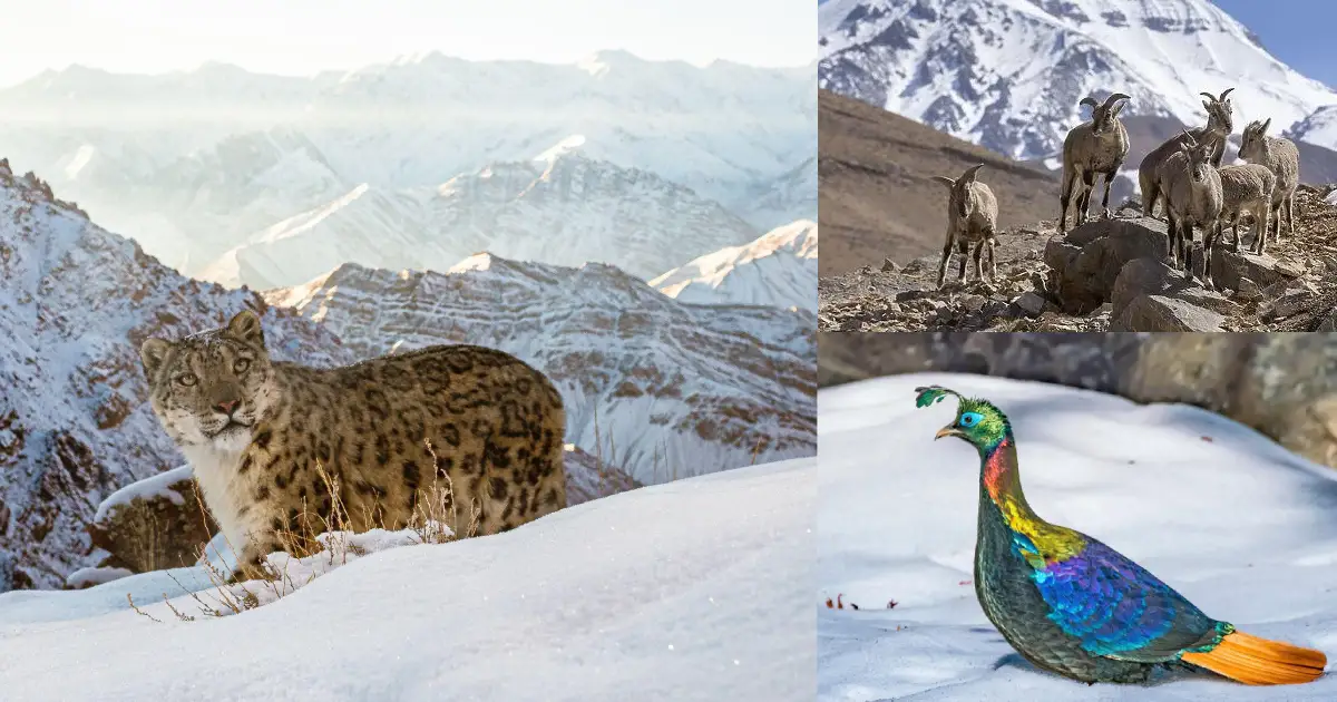
This is cold, steep country, and the animals that live here sit close to the snow line.
- Snow leopard: an estimated 35 live in the park, according to Outlook Traveller, and a 2024 Wildlife Institute of India report on snow leopards named Gangotri as an important area.
- Bharal (blue sheep) and Himalayan tahr: the main grazers on the high slopes
- Musk deer: shy, endangered, found in the forest belt
- Bears: Himalayan black bear and brown bear
- Birds: Himalayan monal, Himalayan snowcock, and around 150 bird species documented so far
The Himalayan monal is the state bird of Uttarakhand, and you can read more in our guide to the Himalayan monal. The Ministry of Tourism also lists the park as an Important Bird Area. Be realistic about sightings, though. The big animals are rarely seen, and most trekkers come home with photos of ice and peaks, not a snow leopard.
Treks Inside Gangotri National Park
- Gaumukh-Tapovan: the most popular route. It crosses the moraine to the glacier snout and then climbs to the meadows of Tapovan, with views of Shivling, the Bhagirathi peaks, and Meru. Gangotri to Tapovan is about 23 km one way.
- Kedartal: a harder trek to a glacial lake at around 4,750 m, below Thalay Sagar. Sources put the distance from Gangotri anywhere between 17 and 26 km.
- Nelang Valley: a cold, dry border valley, often called the Ladakh of Uttarakhand.
- Gartang Gali: a wooden walkway cut into a cliff face, once part of the India-Tibet trade route.
- Auden’s Col: a high pass for experienced mountaineers only.
Gaumukh Trek: Distance, Route and Time
The Gaumukh trek starts at Gangotri and runs about 18 to 19 km one way inside the park. Most people do it in two days, with a night at Bhojbasa, and come back on the second or third day. The Ministry of Tourism describes the park’s treks as ranging from moderate to expert, so please do not treat it like a temple walk.
- Gangotri to Chirbasa: about 9 km through forest, the gentle part
- Chirbasa to Bhojbasa: about 5 km more, where most trekkers spend the night
- Bhojbasa to Gaumukh: about 4 km over loose moraine, slow and tiring
- Gaumukh to Tapovan: a steep scramble beyond the snout
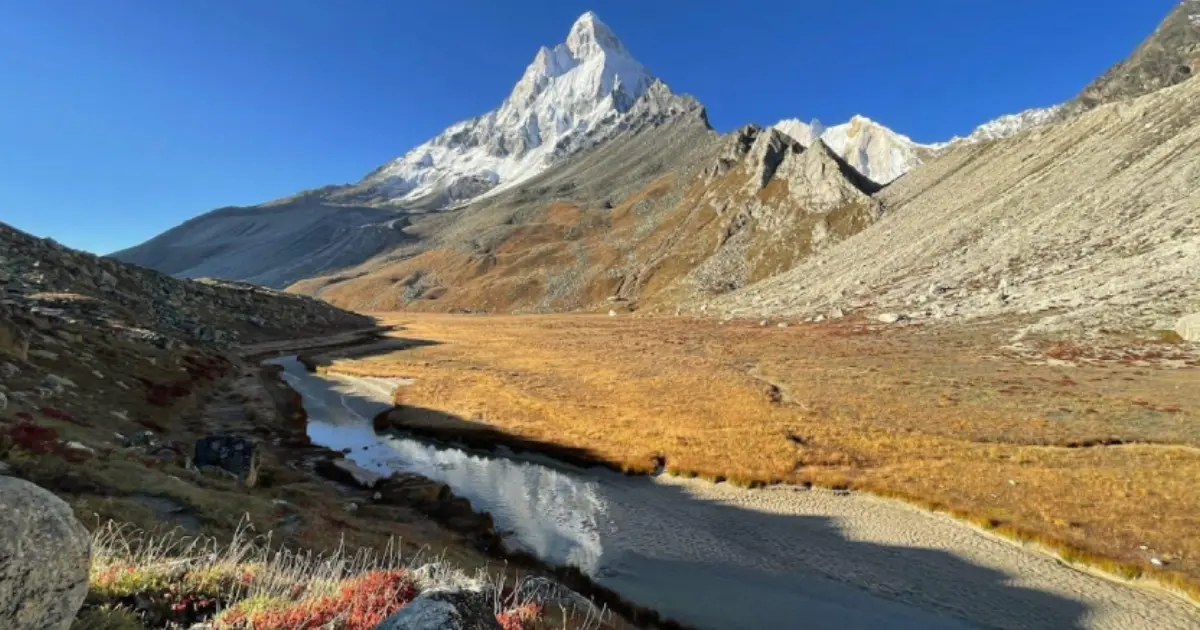
A registered guide is required for Tapovan. Nelang Valley is a separate route with its own conditions, so check with the Forest Department before planning it.
Gangotri National Park Permit and Rules
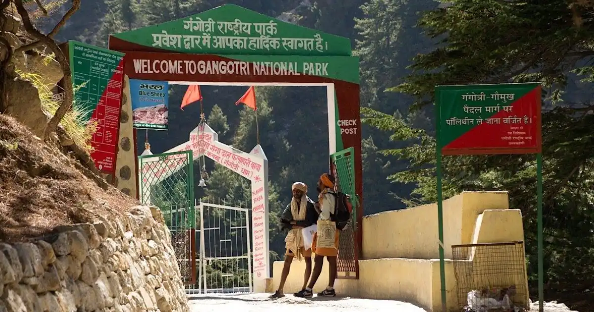
You cannot enter the trek routes without a permit from the Uttarakhand Forest Department. This is what the sources agree on.
- Daily limit: 150 trekkers a day on the Gaumukh trail.
- Where to apply: online through the Pathik portal, or at the forest offices in Uttarkashi or Gangotri.
- Fee: about ₹150 per person for Indian visitors. Several guides quote ₹600 for foreign visitors and a validity of two days, so confirm the current amounts when you apply.
- Guide, insurance, and medical certificate: several recent trekking guides say these have been required since September 2024. Check with the Forest Department before you travel.
- Checkposts: they operate from 6:00 AM, so start early and reach camp before sunset.
- No plastic: carry reusable bags and bring back all your waste.
This permit is separate from the Char Dham registration, which is meant for the temple.
Season, Dates and the 2026 Update
The park opened for the 2026 season on 1 April, and its annual winter break runs from 30 November to 31 March. The Gangotri temple closes earlier; it was scheduled to shut for winter on 10 November 2026. This was also a hard season at altitude, so here is what has been reported.
- Late September: sudden heavy rain and snowfall hit the Gaumukh and Tapovan area. ETV Bharat reported that more than 200 trekkers and mountaineers were stranded and that many were airlifted to safety. Trekking and mountaineering in the park were suspended.
- Early October: the Gaumukh trek reopened with a permit, while Tapovan and Kedartal stayed closed to general trekkers because of heavy snow, according to a report published on 7 October.
- 27 October: a group of 13 (seven trekkers and six support staff) left Gangotri for a three-day Kedartal trek. They were due back on 29 October, but heavy snow blocked the route and an avalanche hit near Bhoj Khadak and Kachcha Dhang. One cook had already come back the next day, and four support staff were rescued on 31 October. Eight people were still missing.
- Search and recovery: NDRF and SDRF teams joined the operation. The latest report we found, from PTI on 6 November, said seven bodies had been recovered, and one person was still missing.
- Permits: The park’s Deputy Director said that no new permits are being issued for Kedartal, Kalindi Khal and Udankol for now.
Conditions on these routes can change within hours, and the season is nearly over. Please check with the Forest Department in Uttarkashi before you plan anything at altitude.
Best Time to Visit Gangotri National Park
The Ministry of Tourism lists May and June as the ideal months, with pleasant days for the temple and for high-altitude trekking. The monsoon brings heavy rain, slippery trails, and landslides, and trekking can be restricted or unsafe. September and October are popular with trekkers after the rains, but this year’s early snowfall is a reminder that the weather in that window can turn fast.
Live Weather at Gangotri
Check the live weather before you start. Conditions at Gangotri can be very different from what you will find at Bhojbasa or Gaumukh, which sit much higher, so treat this as a guide and not a promise.
How to Reach Gangotri National Park
The nearest airport is Jolly Grant in Dehradun, about 268 km away. Rishikesh (about 249 km) and Haridwar (about 275 km) are the closest big railheads. By road, Gangotri is connected through NH 34 from Rishikesh, Haridwar, Dehradun, and Uttarkashi. Helicopter services run from Dehradun to Harsil during the season.
Where to Stay and What to Carry
Gangotri has hotels and ashram dharamshalas, and Uttarkashi has more options if you want a comfortable night before the trek. On the trail, Bhojbasa is the main halt, with a GMVN rest house and seasonal tented camps. Nights are cold even in June. Carry warm layers, a rain jacket, trekking shoes with good grip, sunscreen, sunglasses, a first-aid kit, your own medicines, and a reusable water bottle.
Staying Safe at Altitude
Most of the trek routes lie above 3,000 m, so acute mountain sickness can affect even fit people. The Ministry of Tourism advises spending at least 24 to 48 hours at an intermediate altitude, such as Uttarkashi or Gangotri, before attempting a high trek. Drink water regularly, walk slowly, and avoid alcohol and smoking on the way up. If you have a heart or breathing problem, talk to a doctor first.
Frequently Asked Questions
Where is Gangotri National Park?
In Uttarkashi district of Uttarakhand, in the upper catchment of the Bhagirathi River, along the India-China border.
When was Gangotri National Park established?
In 1989.
How high is Gangotri?
The town and temple are at roughly 3,000 to 3,400 m, depending on the source. Gaumukh is at about 3,900 to 4,000 m, and the park as a whole ranges from about 1,800 m to 7,083 m.
How far is Gaumukh from Gangotri?
About 18 to 19 km one way on foot.
Do I need a permit for Gaumukh?
Yes. A Forest Department permit is compulsory, and the Gaumukh trail is limited to 150 trekkers a day. Permits are issued online and at the forest offices in Uttarkashi and Gangotri.
How much is the Gangotri National Park permit fee?
Guides quote about ₹150 per person for Indian visitors and ₹600 for foreign visitors, with a validity of two days. Confirm the current fee with the Forest Department when you apply.
What is the best time to visit Gangotri National Park?
May and June are the ideal months. September and October also work for trekking, but the weather is less predictable.
Which river starts at Gaumukh?
The Bhagirathi. It meets the Alaknanda at Devprayag, and from there the river is called the Ganga.
Is Gangotri National Park open in winter?
No. The park has an annual winter break from 30 November to 31 March.
Which animals live in Gangotri National Park?
Snow leopard, bharal, Himalayan tahr, musk deer, Himalayan black bear, brown bear, Himalayan monal, and Himalayan snowcock are among those recorded.
Gangotri National Park is not a place for a quick visit. The reward is the ice at Gaumukh, the quiet of Tapovan, and the price is preparation: a permit, a slow climb and respect for the weather. Plan for next season, check conditions before you go, and the source of the Bhagirathi will still be there.
Facts, areas, and dates in this guide were checked against the Ministry of Tourism’s Incredible India page, Outlook Traveller, ETV Bharat, and PTI. Permits, fees, trek openings, and weather can change quickly, so please confirm them with the Uttarakhand Forest Department before you travel.